


-ac017d3d3ce25d3405471795d6bb26f0.jpg "Gia Loc needs over 10 billion VND to invest in renovating and expanding landfills.")

.jpg "Extremely dangerous forest fire risk in Kinh Mon, Chi Linh")

.jpg "Hai Duong City solves the 'problem' of construction waste dumping sites")
.jpg "The North begins a series of hot days")
.jpg "Real estate market in the south of Hai Duong city is bustling")


Submit a comment
It is forecasted that this afternoon, September 19, the center of storm No. 4 (storm Soulik) will make landfall, hitting the provinces from Quang Binh to Quang Tri and causing heavy rain in many central provinces.

On the afternoon of September 19, Mr. Hoang Van Linh, Chairman of the People's Committee of Kim Thuy Commune (Le Thuy District, Quang Binh Province) said that the local government had just evacuated 36 households in the area from the landslide site. Accordingly, the local government had evacuated 36 households with 160 people from Mit Cat village.
“These households are located in areas at risk of landslides, so the commune urgently evacuated them to safe locations. The commune has provided food for the next few days to help people overcome the storm and flood,” said Mr. Linh.
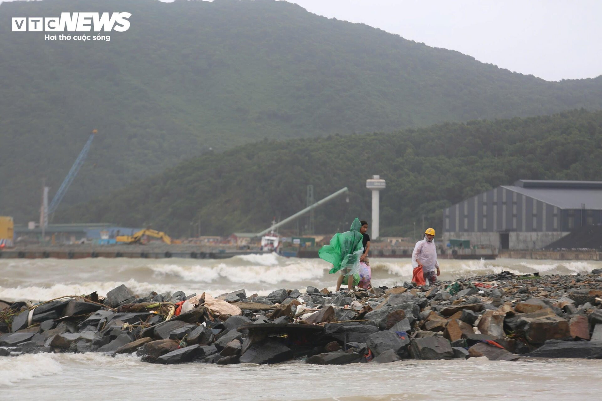
According to the latest information from the Steering Committee for Natural Disaster Prevention, Search and Rescue and Civil Defense of Quang Binh province, as of 11:00 a.m. on September 19, the province had evacuated 238 households with 918 people. The evacuation was concentrated in Le Thuy, Bo Trach, Tuyen Hoa and Minh Hoa districts.
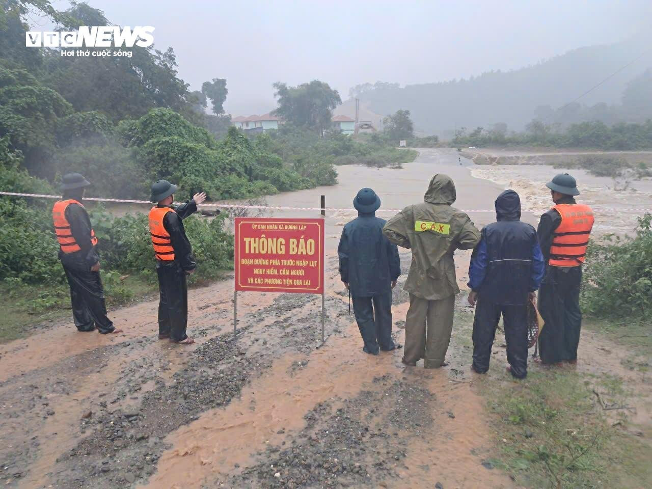
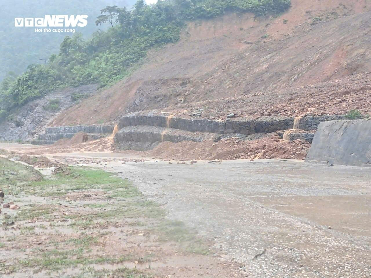
According to Huong Lap Border Guard Station (Huong Hoa), it is currently raining heavily, the water level in rivers and streams is rising, at some spillways the water level is about 0.5m, some locations are at risk of landslides.
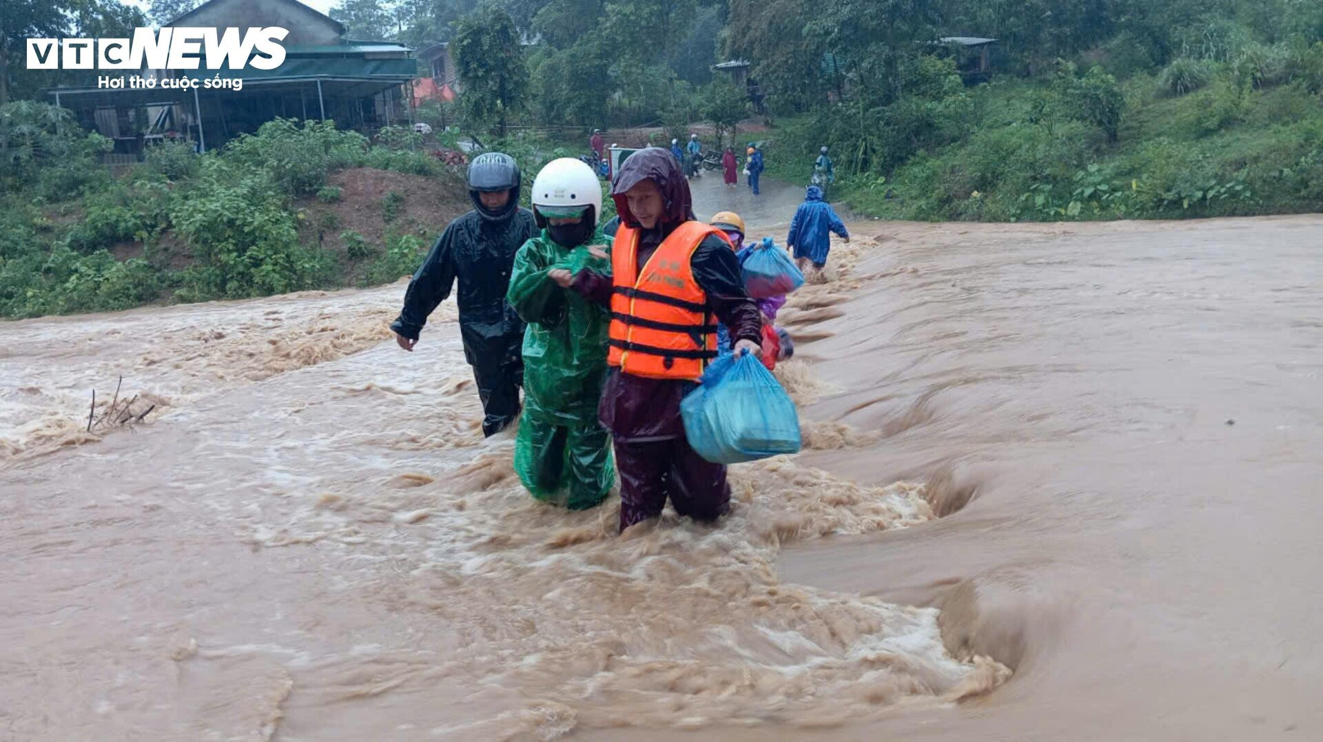
Currently, Tri village and Cuoi and Tri resettlement areas are isolated due to high floodwaters and cannot be passed through. At Cup village resettlement area, there is a slight landslide, the unit has evacuated 4 households/15 people from areas at risk of landslides and floods.


This morning, September 19, at the Department of Dyke Management and Natural Disaster Prevention and Control, Mr. Pham Duc Luan, Director, chaired a meeting to respond to storm No. 4.

At the meeting, Mr. Nguyen Xuan Tung, Deputy Head of the Department of Natural Disaster Response and Overcoming, Department of Dyke Management and Natural Disaster Prevention, Ministry of Agriculture and Rural Development, noted that storm No. 4 has less wind force than storm No. 3, but people should not be subjective to avoid unfortunate damage.
"People should not be subjective or negligent with the intensity of the storm because fishermen are keen on fishing in areas with lots of fish, thinking that their boats can withstand it. Second, we need to pay attention to the rain and floods after the storm. The rain and floods are very heavy, in some places over 500mm, pay attention to the mountainous areas where flash floods and landslides occur, especially in the mountainous areas of Thanh Hoa, Nghe An, Ha Tinh, Quang Binh, Quang Tri, Thua Thien Hue, or deep flooding in areas such as Ha Tinh, riverside areas of Quang Binh, Quang Tri, Thua Thien Hue", Mr. Tung informed.
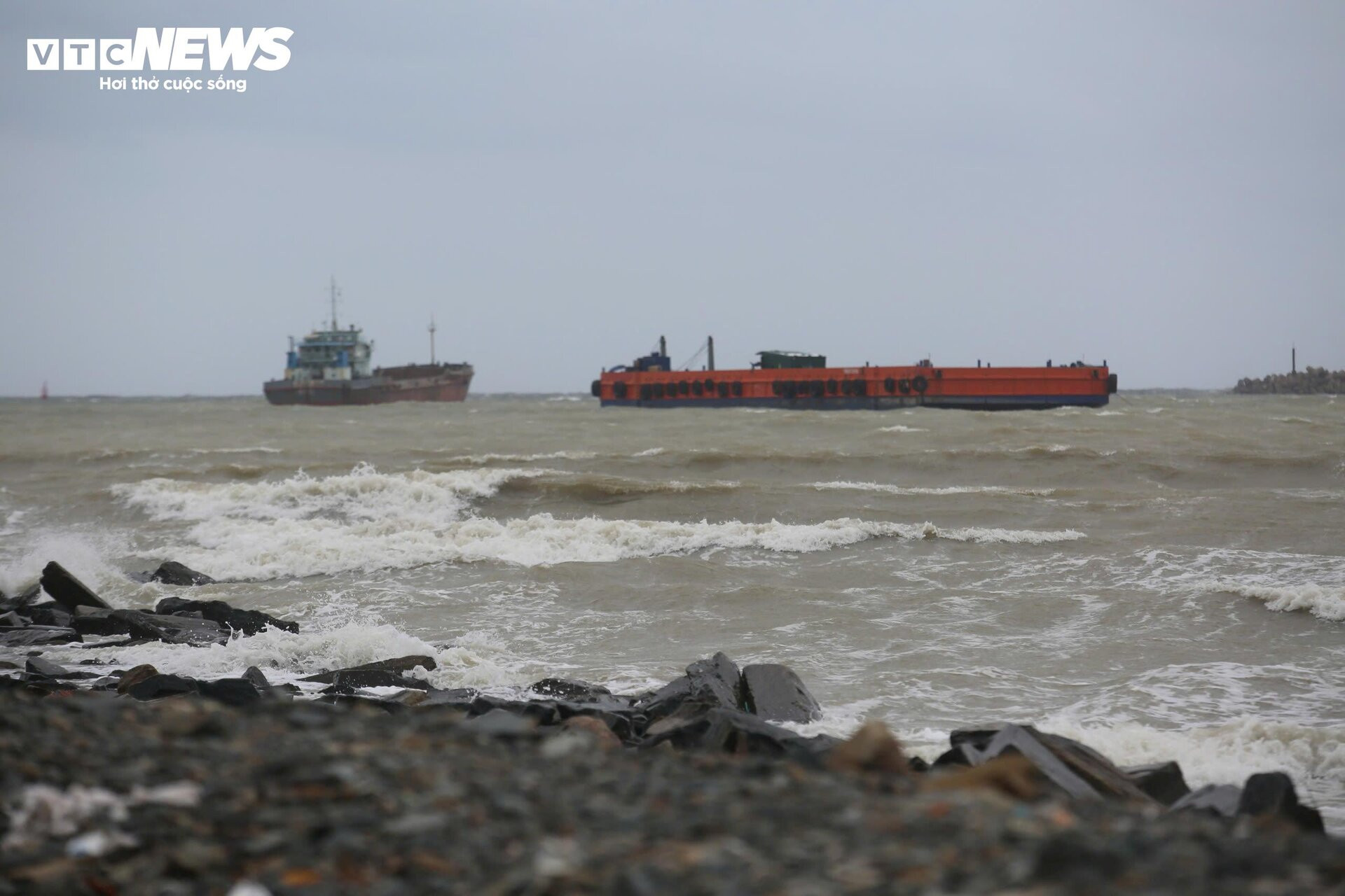
Since early this morning, the circulation area of storm No. 4 has caused very heavy rain. The cloud band causing bad weather stretches from the southern delta to the South Central region. Last night and this morning, in some areas of Thua Thien Hue, Da Nang, Quang Binh, Quang Tri, there was very heavy rain, with rainfall in some places exceeding 200mm.
According to the National Center for Hydro-Meteorological Forecasting, at 2:00 p.m. on September 19, storm No. 4 weakened into a tropical depression.
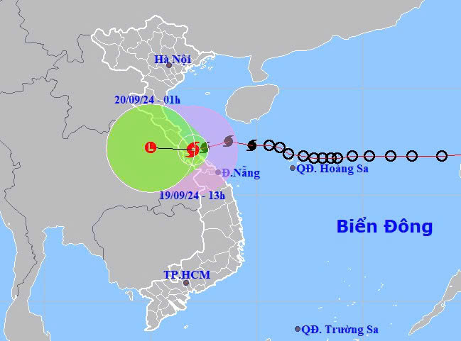
The center of the tropical depression is located at about 16.9 degrees North latitude, 106.9 degrees East longitude, on the mainland of Quang Binh - Quang Tri provinces, with the strongest wind at level 7 (50-61km/h), gusting to level 10.
It is forecasted that in the next 3 hours, the tropical depression will move in the West Southwest direction, at a speed of about 15-20km/h.
TB (summary)