


")


.jpg "Kim Thanh reclaims more than 234 hectares of land to build an industrial park")


.jpg "Binh Giang's first quarter budget revenue reached nearly half of the province's annual target.")
.jpg "Early spring tea")

Submit a comment
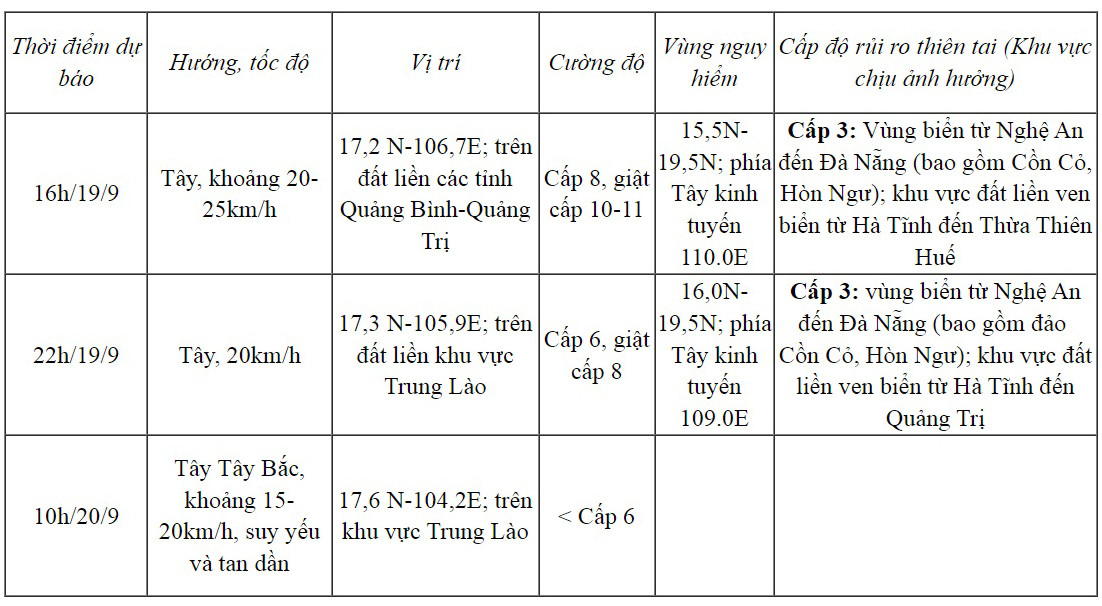
At noon on September 19, storm No. 4 increased to level 8-9, gusting to level 11, the center of the storm was located in the coastal waters from Quang Binh to Thua Thien Hue. It is forecasted that from September 19-20, the Hai Duong area will have moderate to heavy rain.
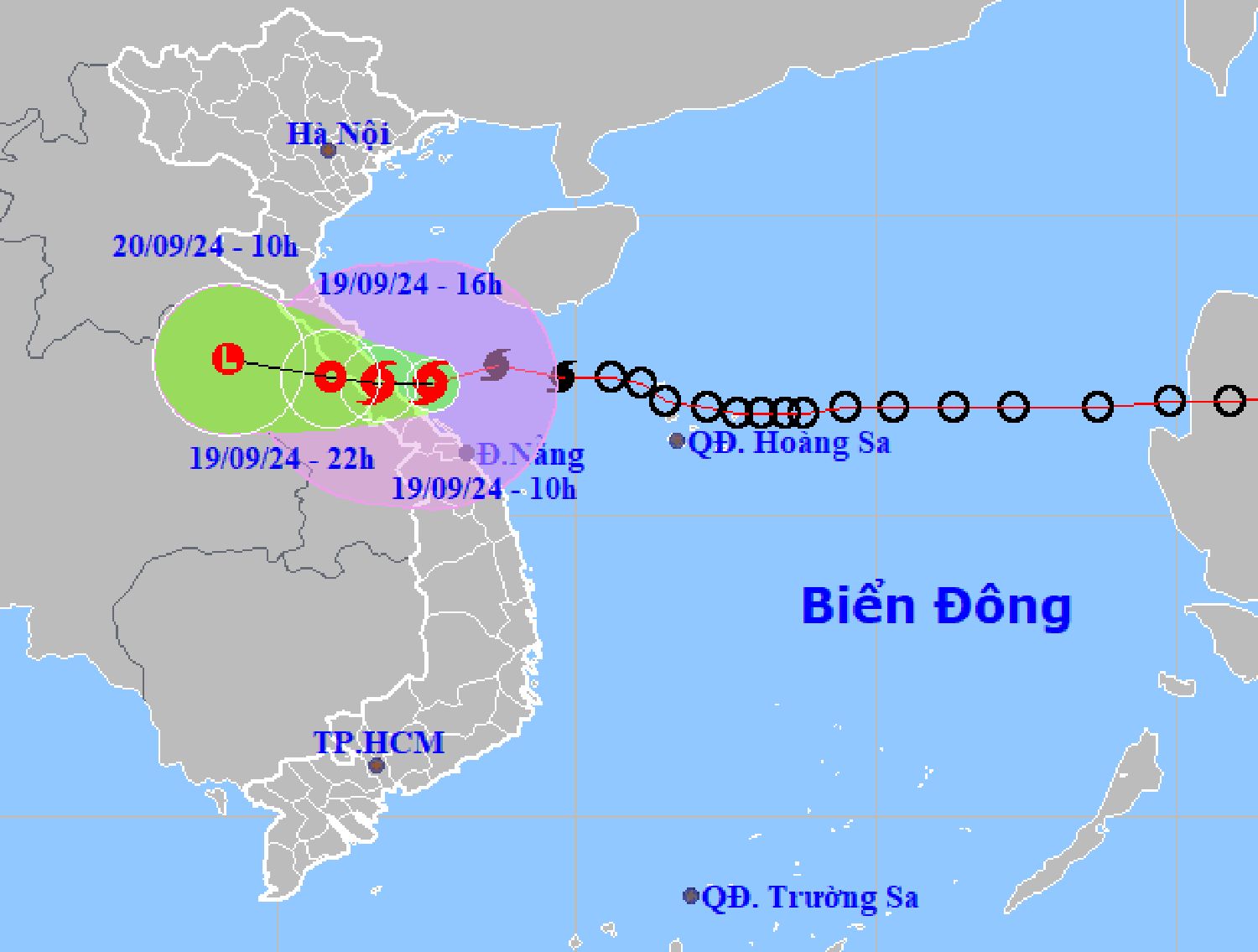
According to the National Center for Hydro-Meteorological Forecasting, at 12 noon on September 19,The center of storm No. 4 is located at about 17.2 degrees North latitude; 107.1 degrees East longitude, on the coastal waters from Quang Binh to Thua Thien Hue. The strongest winds are near the center of the storm.strong level 8-9 (62-88km/h), jerk level 11.
Forecast in the next 3 hours, the storm moves west, speed about 20-25km/h.
Forecast of storm No. 4 in the next 12-24 hours
Due to the storm's influence, in Con Co (Quang Tri), there were strong winds of level 9, gusting to level 10; in Hoanh Son (Ha Tinh), there were strong winds of level 6, gusting to level 8; in Le Thuy (Quang Binh), there were strong winds of level 6, gusting to level 8.
Last night until this morning, September 19, in the North and Central Central regions, there was moderate rain, heavy rain, and in some places very heavy rain: Hoa Bac (Da Nang) 152mm; Bach Ma (Thua Thien Hue) 270mm, Huong Phu (Thua Thien Hue) 249mm; Quang Tri 112mm...
It is forecasted that from September 19-20, in the North Central and South Central regions, there will be heavy to very heavy rain with common rainfall from 100-300mm, locally over 500mm.
According to the Hai Duong Province Hydrometeorological Station, from September 19-20, Hai Duong will have moderate rain, with some places experiencing heavy rain. During thunderstorms, there is a possibility of tornadoes, lightning, and strong gusts of wind. Rainfall is generally 30-50mm, with some places experiencing over 70mm.
VN


.jpg "Hai Duong's agricultural, forestry and fishery value increased by 7.51% in the first quarter.")