


Submit a comment
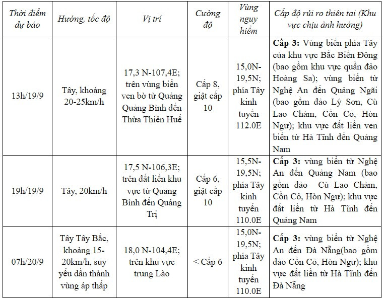
At noon on September 19, storm No. 4 moved faster than expected with wind gusts of level 8-9 (62-88km/h), gusts of level 11.
Latest news on storm number 4 at noon on September 19: Storm moves faster
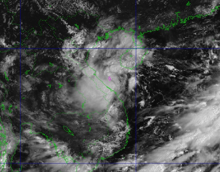
According to the National Center for Hydrometeorology Latest storm number 4 news at noon on September 19 giving the location of the storm's center: About 17.2 degrees North latitude; 107.6 degrees East longitude, on the coastal waters from Quang Binh to Thua Thien Hue. Strongest wind: Level 8-9 (62-88km/h), gusting to level 11. Forecast, in the next 3 hours, the storm will move westward, at a speed of about 20-25km/h. Before that, the storm moved mainly westward at a speed of about 20km/h.
Due to the influence of storm No. 4, Ha Tinh has strong winds of level 6, gusting to level 8; Dong Hoi (Quang Binh) has strong winds of level 7.
Last night until this morning, in the North and Central Central regions, there was moderate rain, heavy rain, and in some places very heavy rain: Hoa Bac (Da Nang) 152mm; Bach Ma (Thua Thien Hue) 270mm, Huong Phu (Thua Thien Hue) 249mm; Drakrong (Quang Tri) 112mm...
Forecast of impacts on sea and land
According to the forecast from the National Center for Hydro-Meteorological Forecasting, due to the influence of storm No. 4, on the morning of September 19, the western sea area of the North East Sea (including the Hoang Sa archipelago) will have strong winds of level 6-7 (39-61km/h), gusts of level 9 (75-88km/h), waves 2.0-4.0m high, and rough seas.
The sea area from Nghe An to Quang Ngai (including Ly Son island district, Cu Lao Cham, Con Co, Hon Ngu) has strong winds of level 6-7 (39-61km/h), waves 2.0-4.0m high, the area near the storm center has winds of level 8 (62-74km/h), gusts of level 10 (89-102km/h), waves 3.0-5.0m high, rough seas.
In addition, due to the influence of the strong southwest monsoon, in the sea area from Binh Dinh to Ca Mau, the South of the Central East Sea area and the South East Sea area (including the sea area of Truong Sa archipelago), there is strong southwest wind level 6, sometimes level 7, gusting to level 8-9, waves from 3.0-5.0m high. The sea is rough. The northern area of Bac Bo Gulf has strong wind level 5, sometimes level 6, gusting to level 7-8. Waves from 2-3.5m high. Rough sea.
From September 19 to September 20, in the North Central and Central Central regions, there will be heavy to very heavy rain with common rainfall from 100-300mm, locally over 500mm. Beware of heavy rain (>150mm/6 hours) in the area from Quang Tri to Da Nang on September 19.
InHai Duong,According to the forecast of the provincial Hydrometeorological Station, the storm will affect Hai Duong province from today, September 19 to September 21, with showers and thunderstorms; locally heavy rain and thunderstorms. During thunderstorms, there is a possibility of tornadoes, lightning and strong gusts of wind; rainfall is generally 30 - 50mm, with some places over 70mm.
PV