


.jpg "Anomalies discovered at the bottom of the Indian Ocean, possibly the location of the MH370 crash")


.jpg "Real estate market in the south of Hai Duong city is bustling")

.jpg "Extremely dangerous forest fire risk in Kinh Mon, Chi Linh")


-ac017d3d3ce25d3405471795d6bb26f0.jpg "Gia Loc needs over 10 billion VND to invest in renovating and expanding landfills.")


Submit a comment
European countries are suffering from record-breaking snowstorms and cold as more than a metre of snow falls, causing hundreds of flights to be cancelled and road traffic to be disrupted.
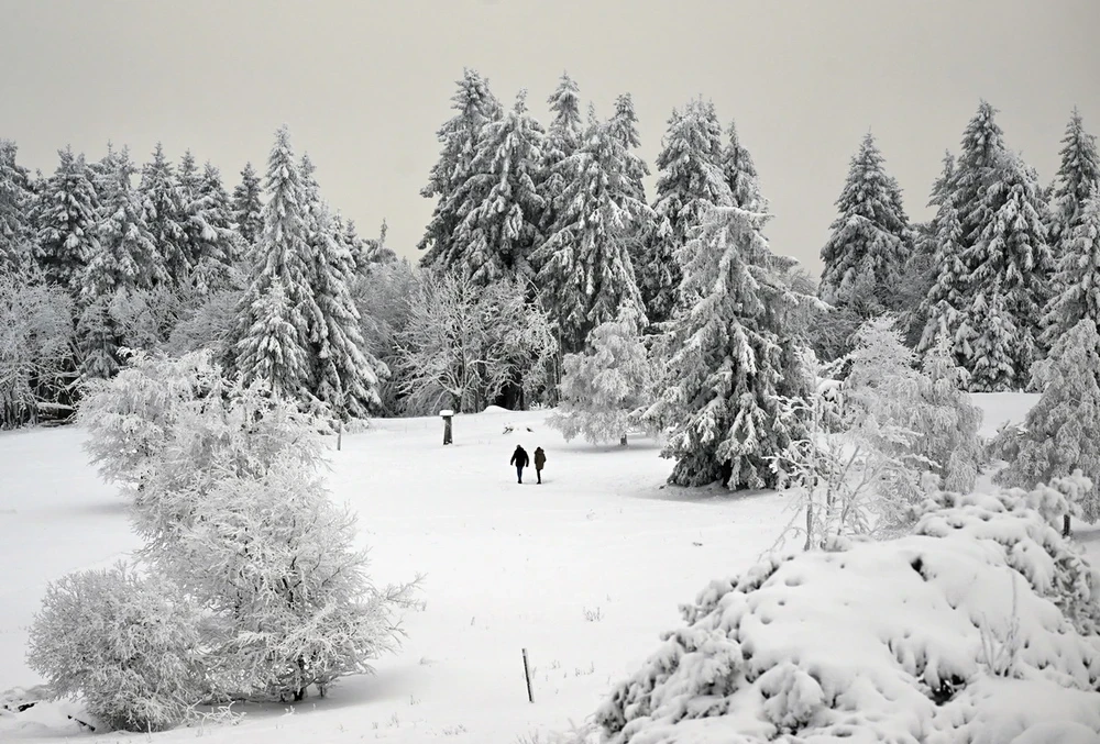
Much of Europe is entering winter with cold weather and heavy snowfall, a stark contrast to last year when the weather was unusually warm and snow-free.
In Munich, Germany's third largest city, nearly 1.5 meters of snow fell over the weekend, setting a record for December. It was also the city's biggest snowstorm since early March 2006.
Munich is not the only city in Europe suffering from an unusual winter. Germany and the rest of Europe are being blanketed in snow, particularly from the Alps north through Germany and into parts of Eastern Europe.
Heavy snowfall has forced hundreds of flights to be canceled, according to flight tracking company FlightAware. In Munich, hundreds of flights have been canceled every day since last weekend because of snow. Amsterdam Airport, Glasgow Airport and many other airports have temporarily suspended operations.
Snow also affected road transport and other utilities. In Cumbria, in north-west England, up to half a metre of snow left many vehicles stranded and around 13,000 customers without power.
Heavy snowfall across Europe
Satellite imagery and ground observations show significant snowfall across Europe. According to MeteoSwiss, the Swiss weather service, snow monitoring stations such as those in the Alps recorded above-average snowfall, with some locations reaching record levels for the time of year.
")
“Europe could be experiencing its snowiest winter since 2010,” French meteorologist Nahel Belgherze wrote on social network X, formerly Twitter.
In the Alps, snow accumulation began in mid- to late November, as cold air began to move south from northern Europe, where temperatures had been below normal since October. In recent weeks, only the Iberian Peninsula and countries around the Mediterranean Sea have largely escaped the cold.
Amid heavy snowfall in southern Germany, temperatures have dropped to near or even below minus 18 degrees Celsius, a low that is more common in the Scandinavian countries of northern Europe.
Snow cover in the Northern Hemisphere is above average.
Snowfall in the Northern Hemisphere has been near-average over the past eight weeks, according to the National Oceanic and Atmospheric Administration and Rutgers University. This comes despite below-average snowpack in North America.
Cold weather and heavy snowfall have also hit parts of Russia, including Siberia, in recent days. One of the heaviest snowfalls on record hit Moscow on December 4, causing flights to be canceled and many drivers to be stranded on the roads.
")
According to weather forecaster Thierry Goose, temperatures in Siberia have plummeted to -50 to -57 degrees Celsius in recent days, an exceptionally low level for this early winter.
The harsh winter weather in Europe is linked to a negative phase of the Arctic Oscillation (AO), which allows cold air from near the Arctic to move south.
It tends to support a pattern where cold air is pushed south across the British Isles before curling across southern and central Europe. Often this cold air also extends into eastern Europe and Asia, as it has done this week.
But as the negative Arctic Oscillation is cooling and forecast to move towards neutral, the winter chill could gradually ease. Western Europe will thaw this week, while the cold will ease in Eastern Europe and Russia next week.
Despite the harsh winter weather that has gripped Europe, much of the rest of the planet continues to experience much warmer-than-normal conditions. Data shows that last month was the warmest November on record for Earth, and the fifth consecutive month of record-breaking temperatures.
According to Vietnam+