


.jpg "Real estate market in the south of Hai Duong city is bustling")

.jpg "Extremely dangerous forest fire risk in Kinh Mon, Chi Linh")


-ac017d3d3ce25d3405471795d6bb26f0.jpg "Gia Loc needs over 10 billion VND to invest in renovating and expanding landfills.")


Submit a comment
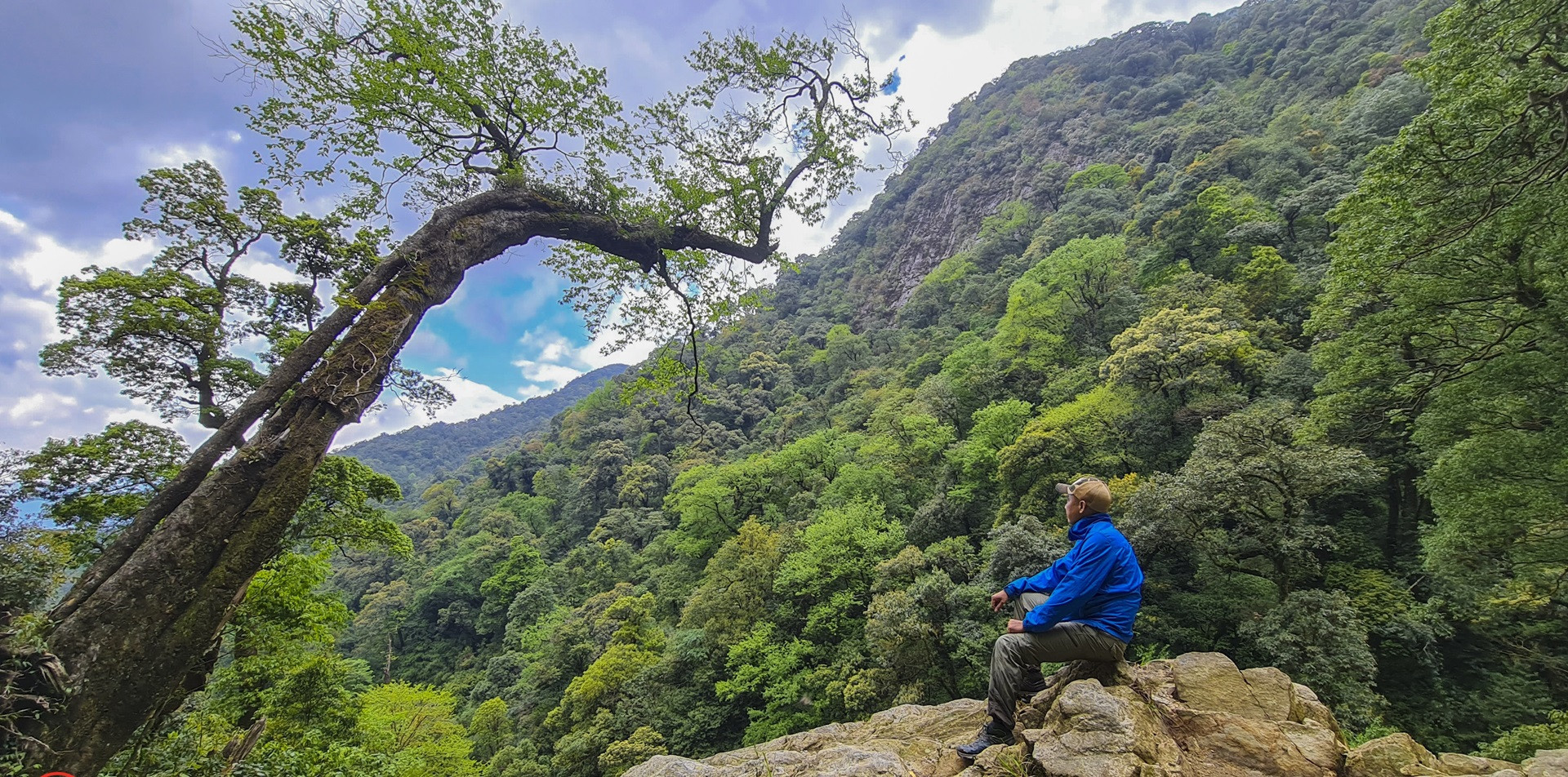
Nam Kang Ho Tao Peak is a dream destination for adventurous backpackers because of the difficulty and wild beauty of the mountains and forests here.
With an altitude of 2,881m, Nam Kang Ho Tao peak is located in sub-region 303A, Hoang Tha Thau mountain, Ta Trung Ho village, Ban Ho commune, Sapa town and is located in Hoang Lien National Park.
Discovered in 2017, quite late compared to many other peaks, Nam Kang Ho Tao immediately became one of the two most difficult mountains to conquer in the Northwest next to Pusilung peak due to the long route, steep cliffs and fierce streams.
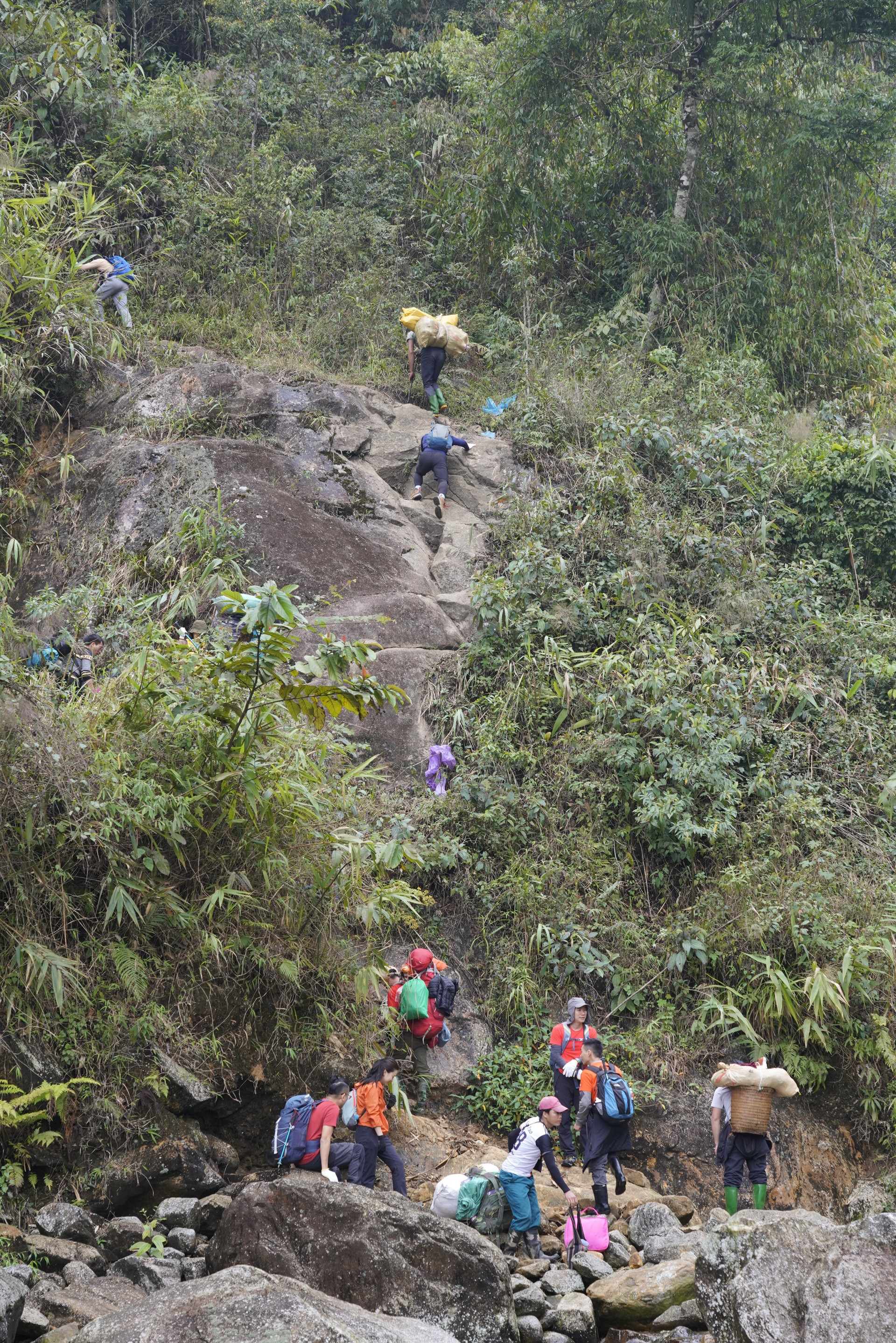
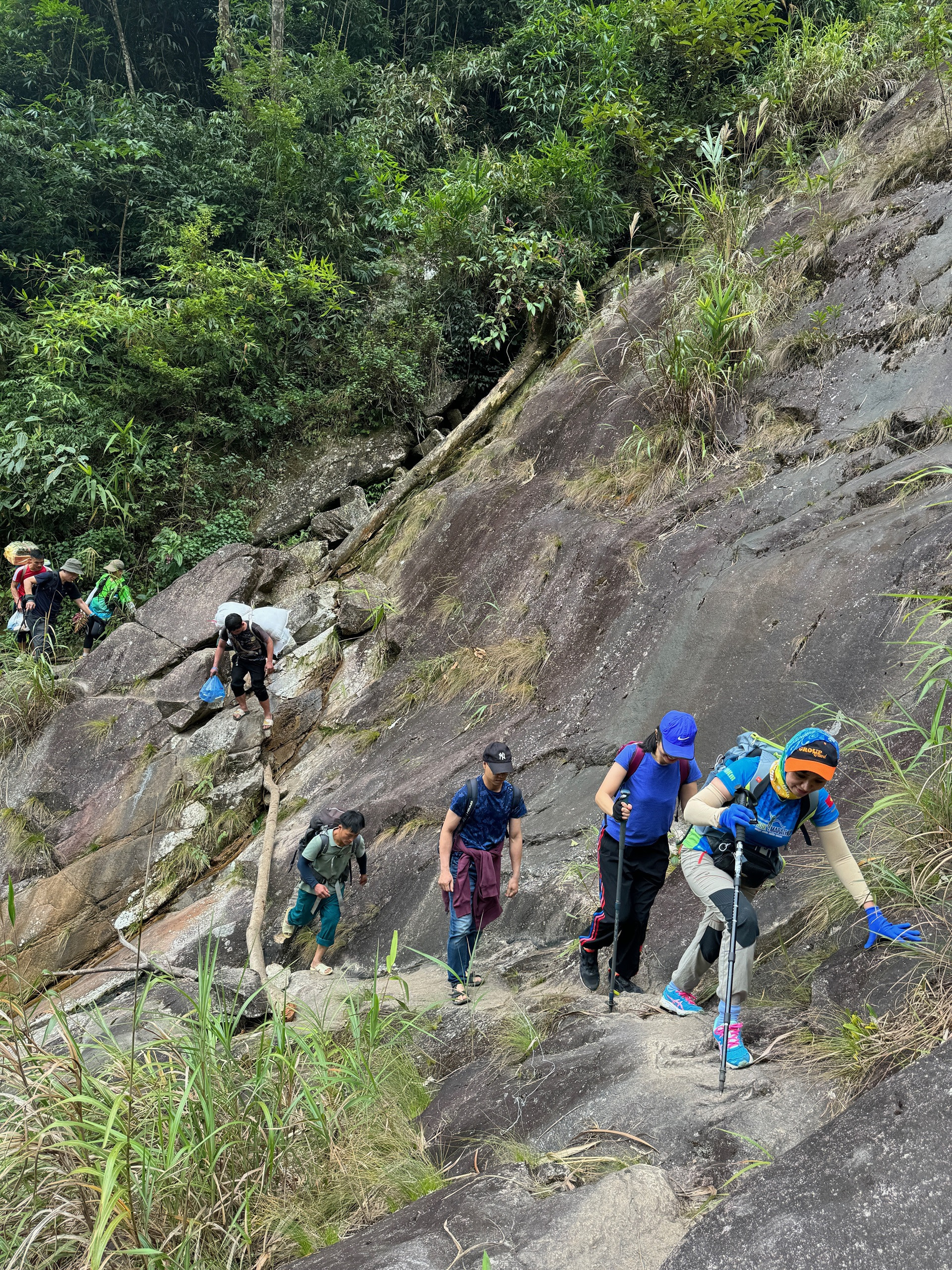
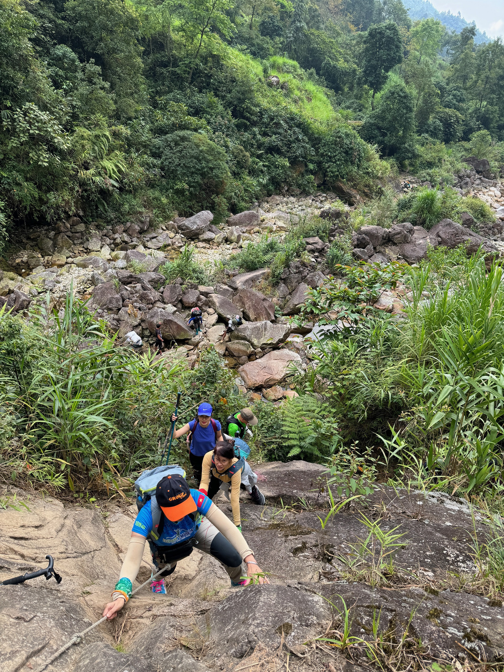
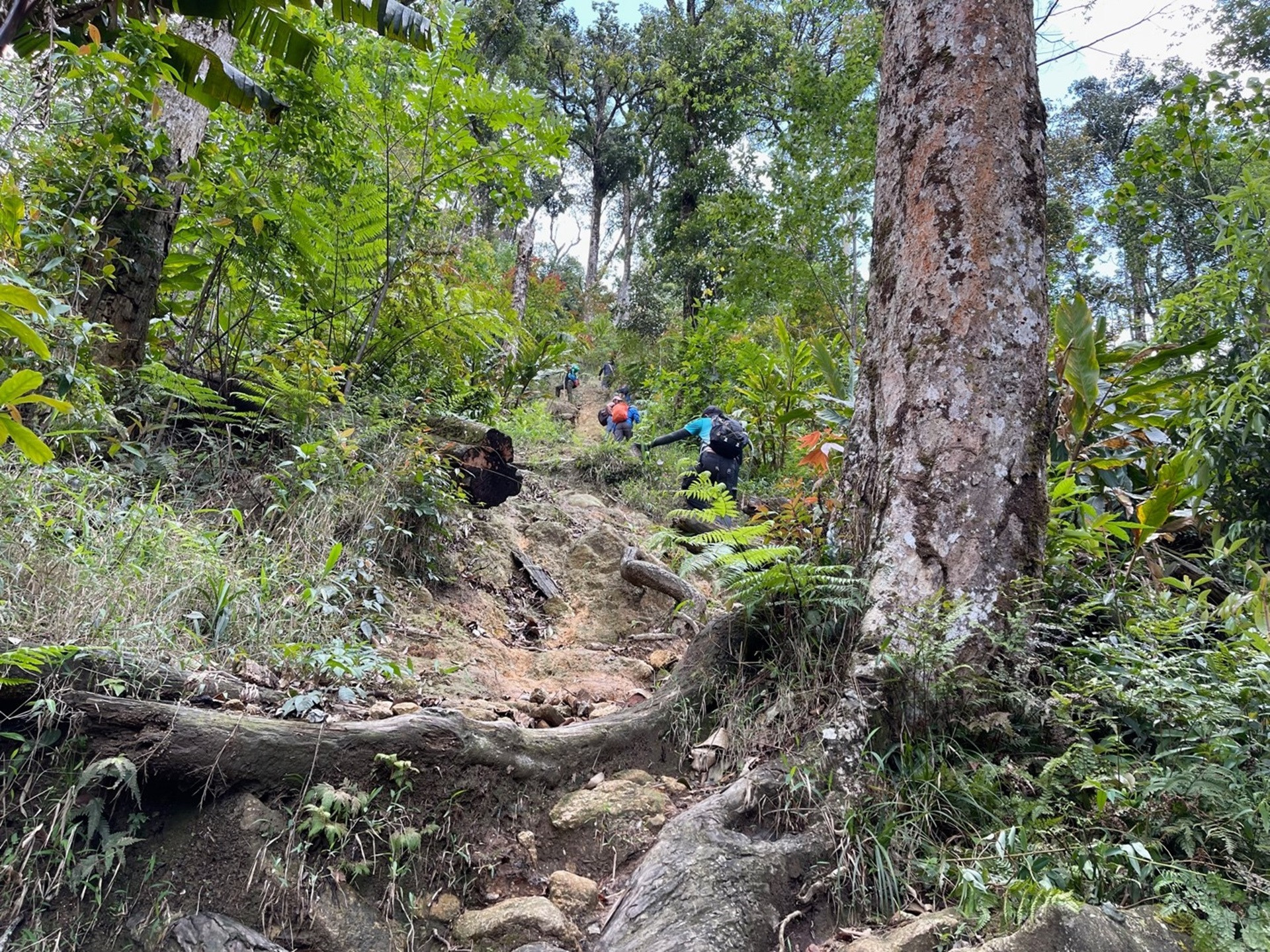
The distance from the foot of the mountain to the rest house is about 12 km but can take up to 8-9 hours to climb due to the difficult and steep road. According to the porters (local guides and porters), the first 4 km is the most dangerous part of the climb because there are many sections that have to go through steep cliffs.
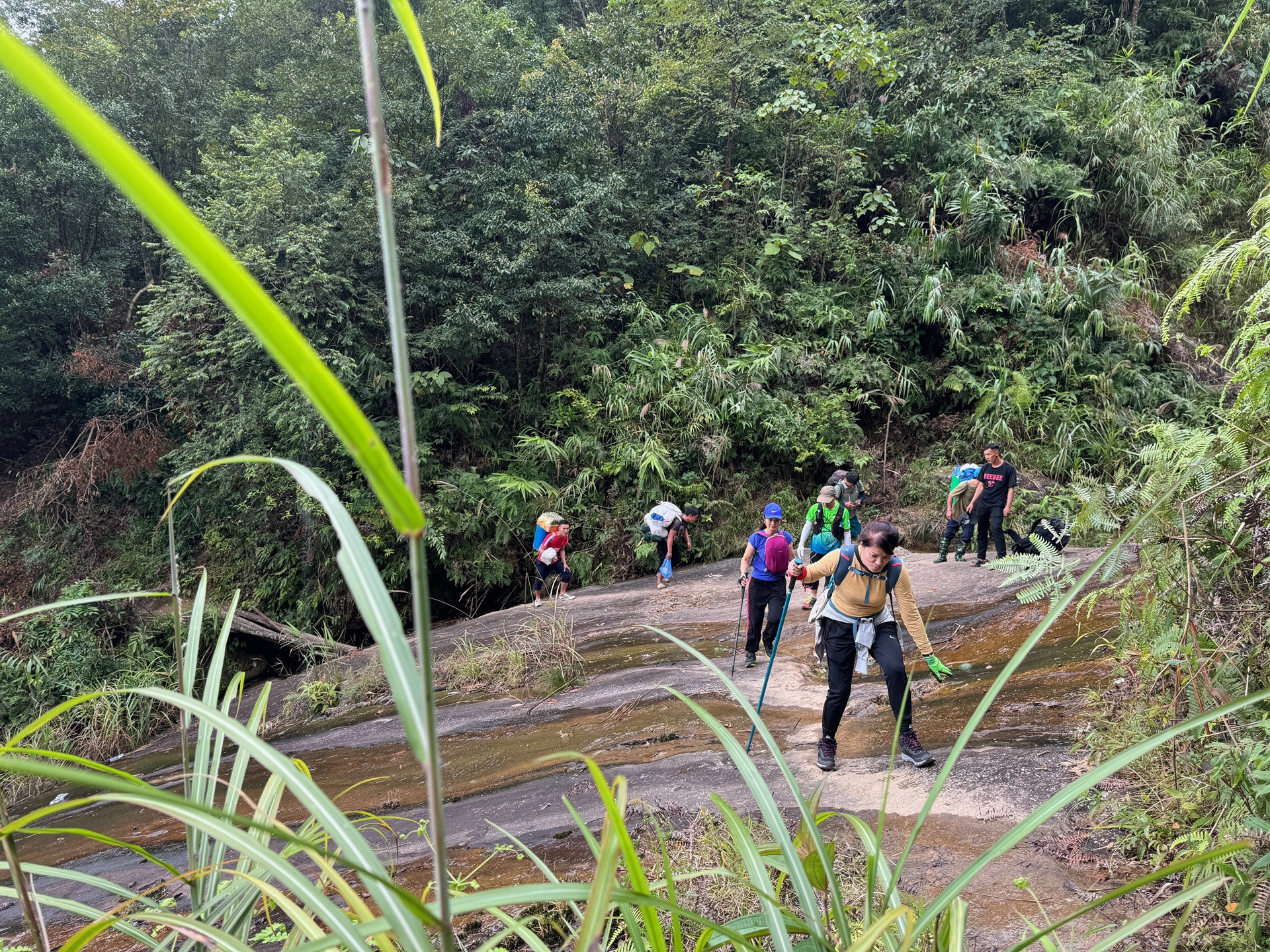
Trekkers who are passionate about exploring the natural beauty of the Northwest mountains and forests and challenging their own limits often conquer Nam Kang Ho Tao in 3 days and 2 nights. They start from Thao A village, Tan Uyen district, Lai Chau province and return in the same direction with a total length of about 50 km or go to Lai Chau and return via Den Thang village, Sapa town, Lao Cai province with a total length of 44 km. Going back through Lao Cai must have permission from Hoang Lien National Park.
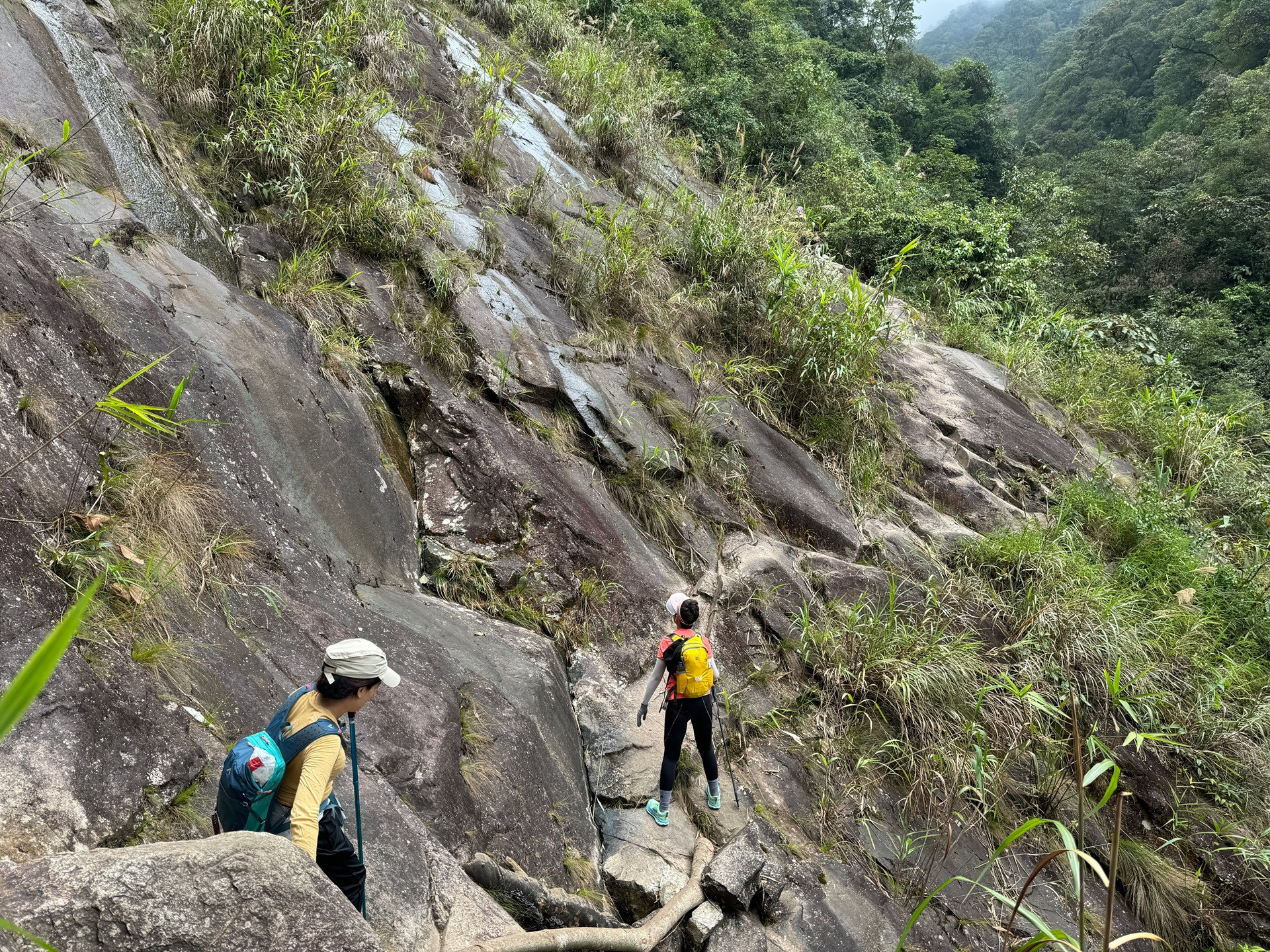
According to Manh Chien, administrator of the Association of Mountaineering Enthusiasts with more than 100,000 members, the mountain climbing movement is currently developing strongly, however, trekkers need to practice carefully before climbing and measure their strength for each climbing route. "The Nam Kang Ho Tao climbing route is not for beginners and even experienced climbers. If it rains, you should not continue because the steep cliffs are slippery at that time, it is very dangerous to try to overcome", Mr. Chien shared.
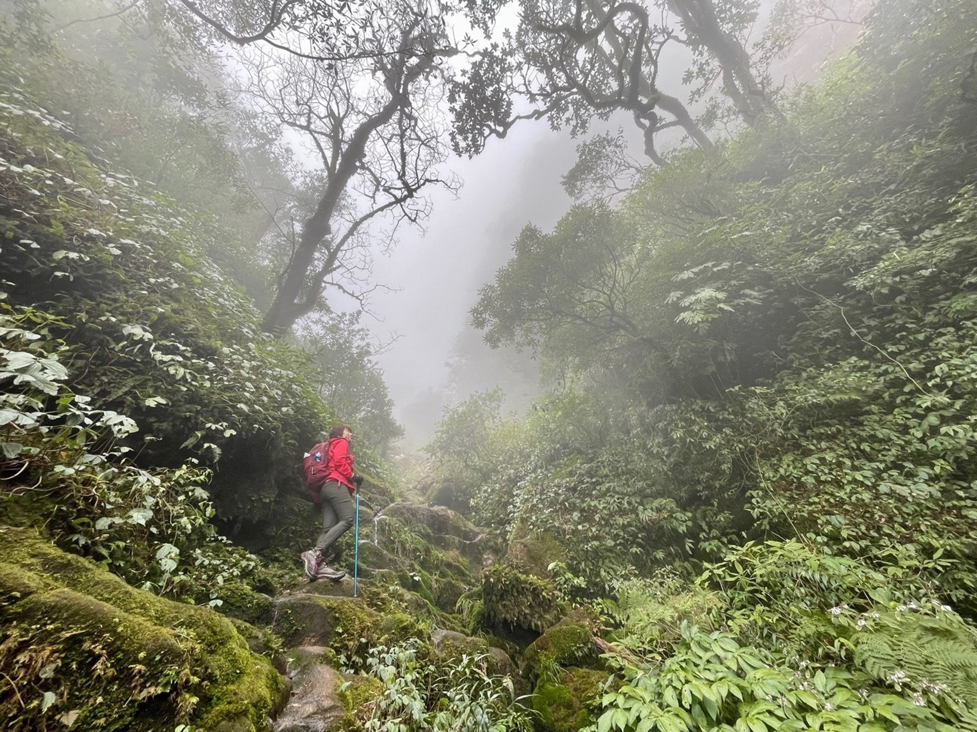
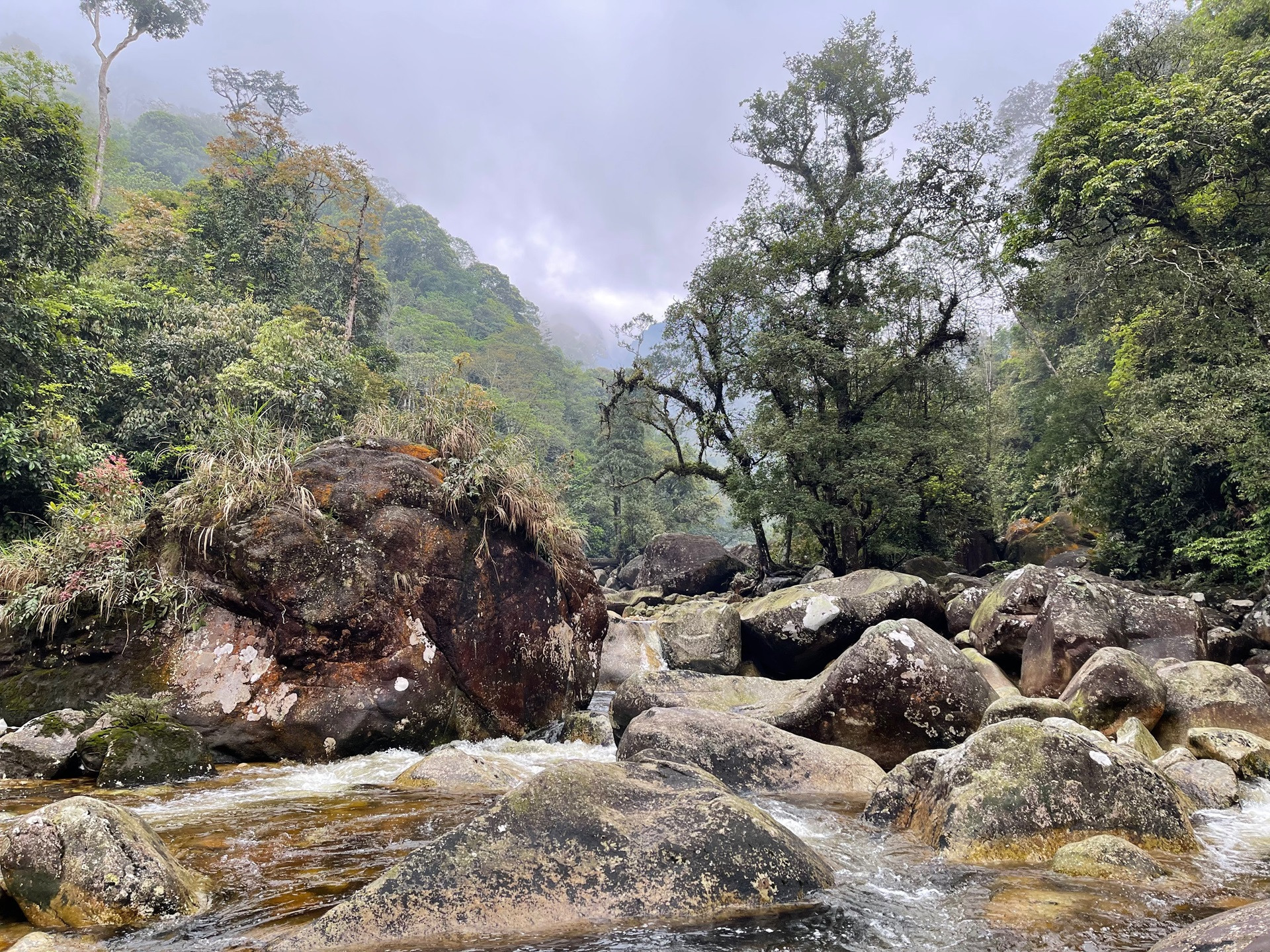
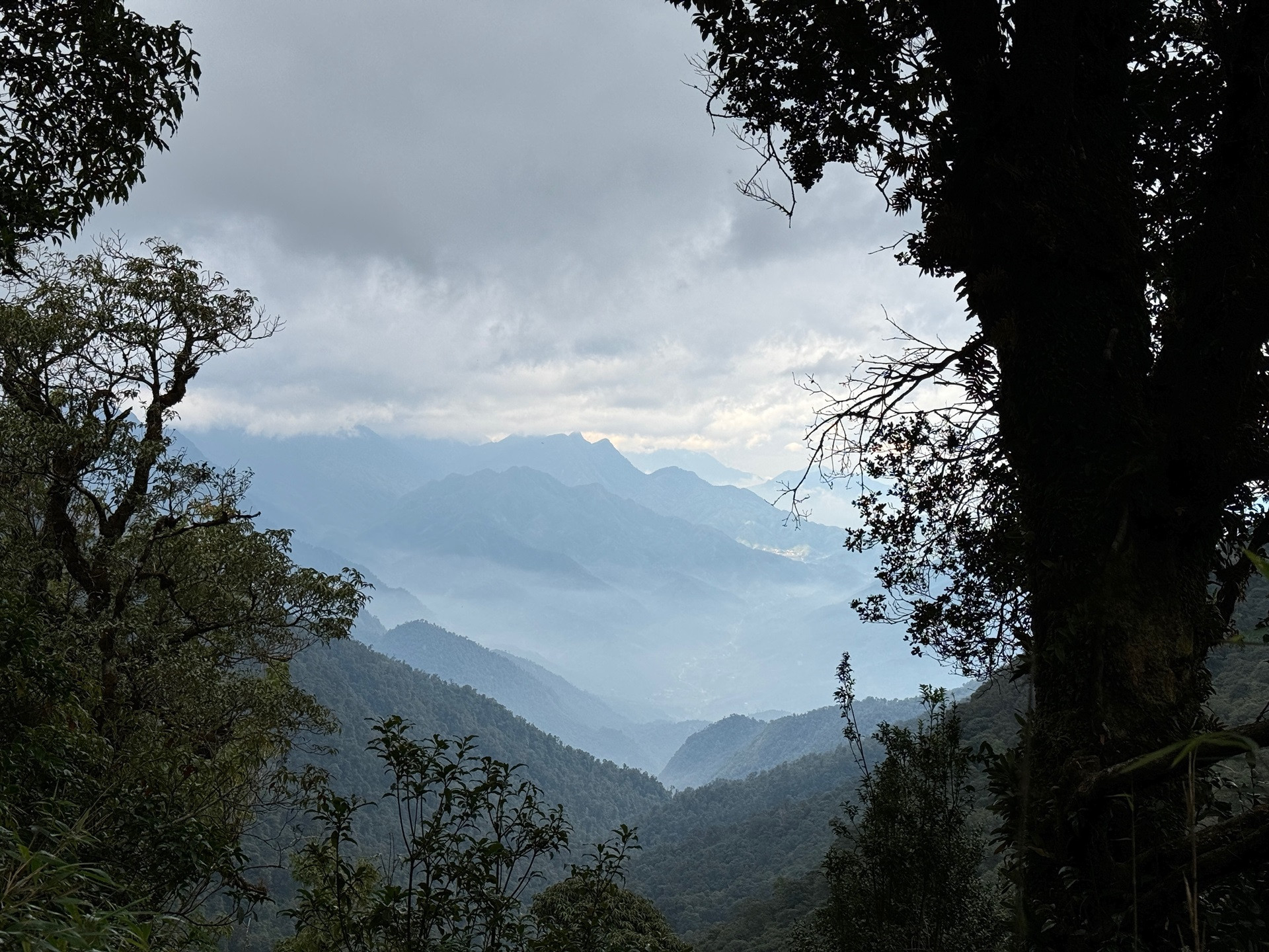
The higher you go into the primeval forest, the scenery and weather change. The fog and colder weather make the forest and streams more beautiful and magical.
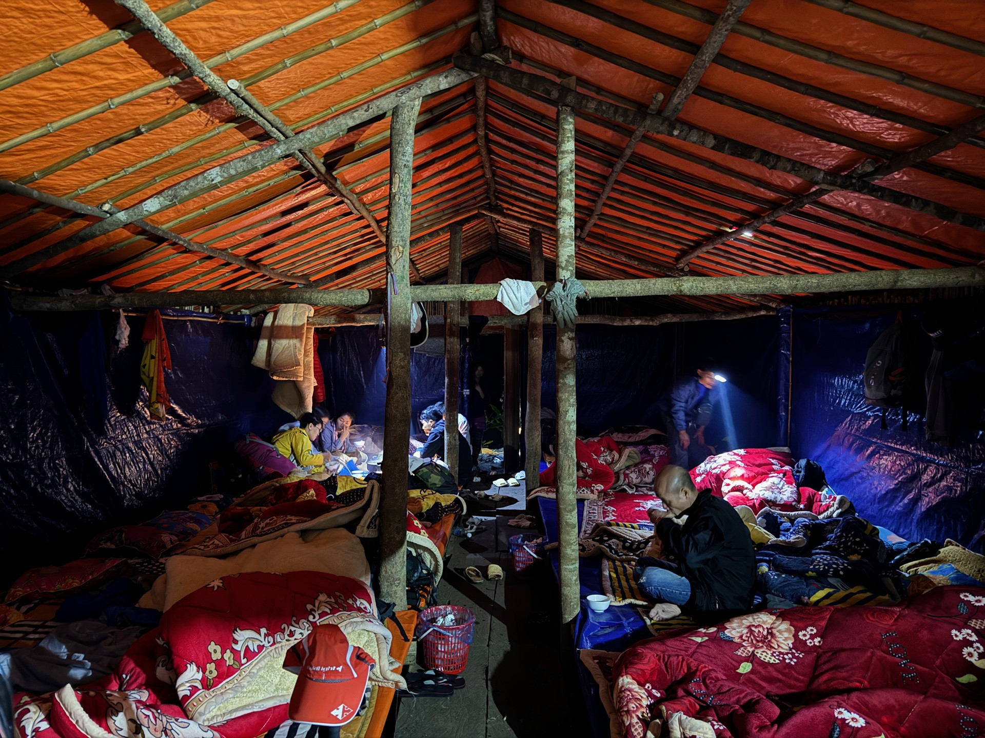
After about 8-9 hours of climbing, trekkers will reach the resting area built by the locals a year ago. The main hut can accommodate about 60 people. Another smaller hut located not far away can accommodate about 40 people. Water for the hut is brought from a stream not far away.
Before there were no service huts, tourists and porters had to set up tents to sleep. It was very cold at night and they also had to work harder because they had to carry tents, pots, pans, dishes and sleeping bags.
Our group of 8 experienced climbers conquered Nam Kang Ho Tao early this November. The dry and cool weather helped us have a successful and safe trip.

The road from Nam Kang Mountain towards Lao Cai through Hoang Lien National Park is currently closed to trekkers unless permitted. Due to the lack of traffic, the path is completely overgrown with trees.
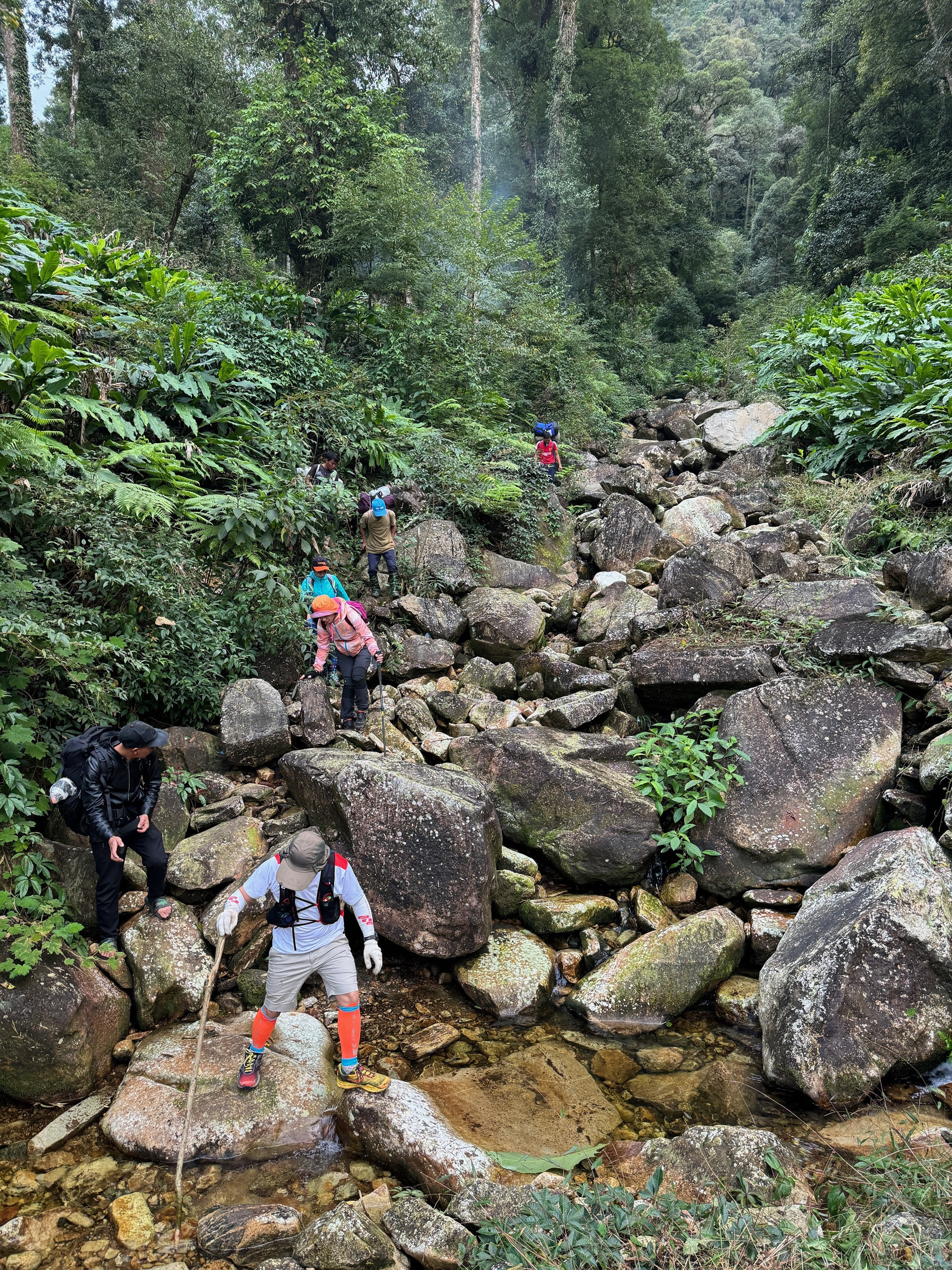
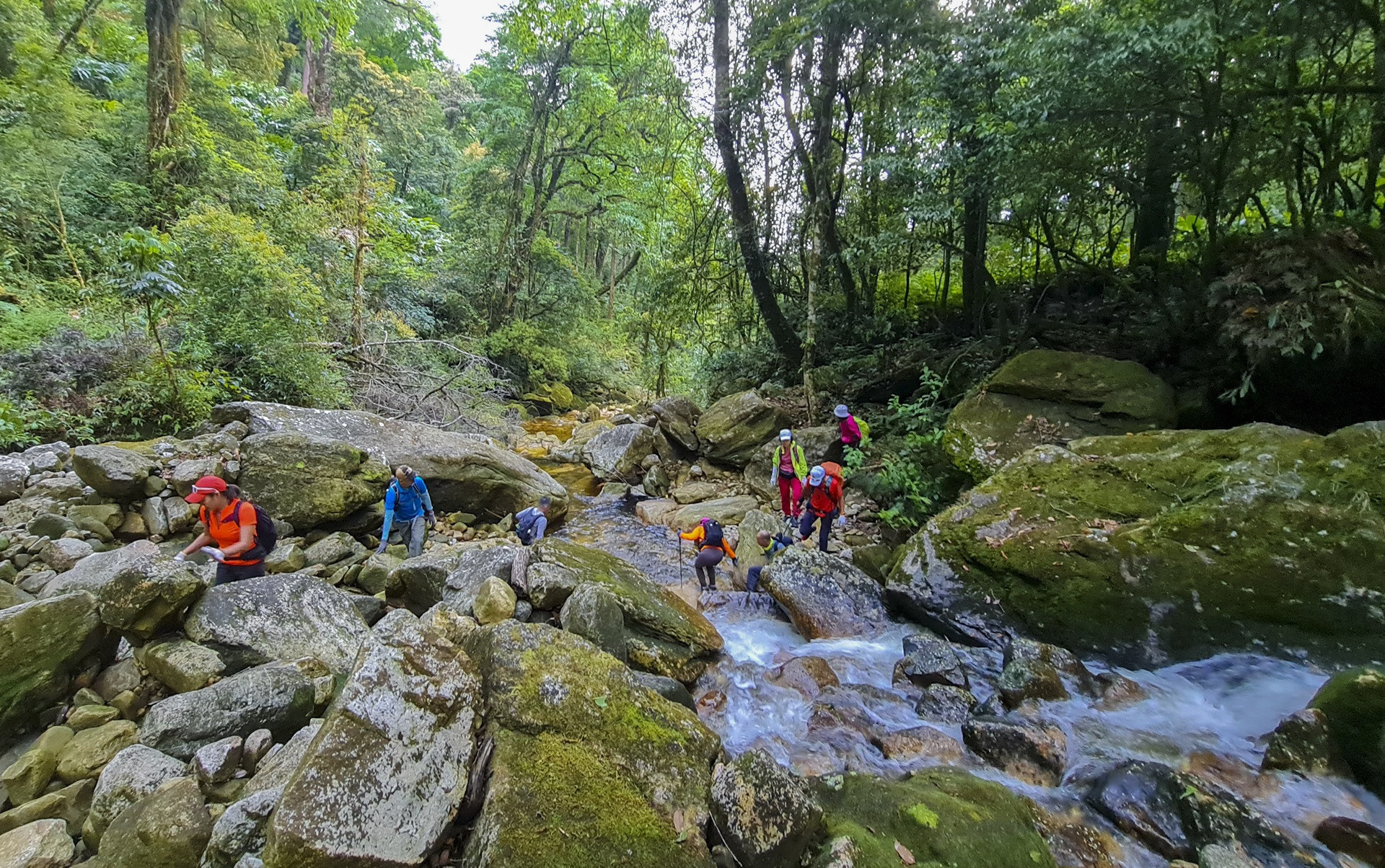
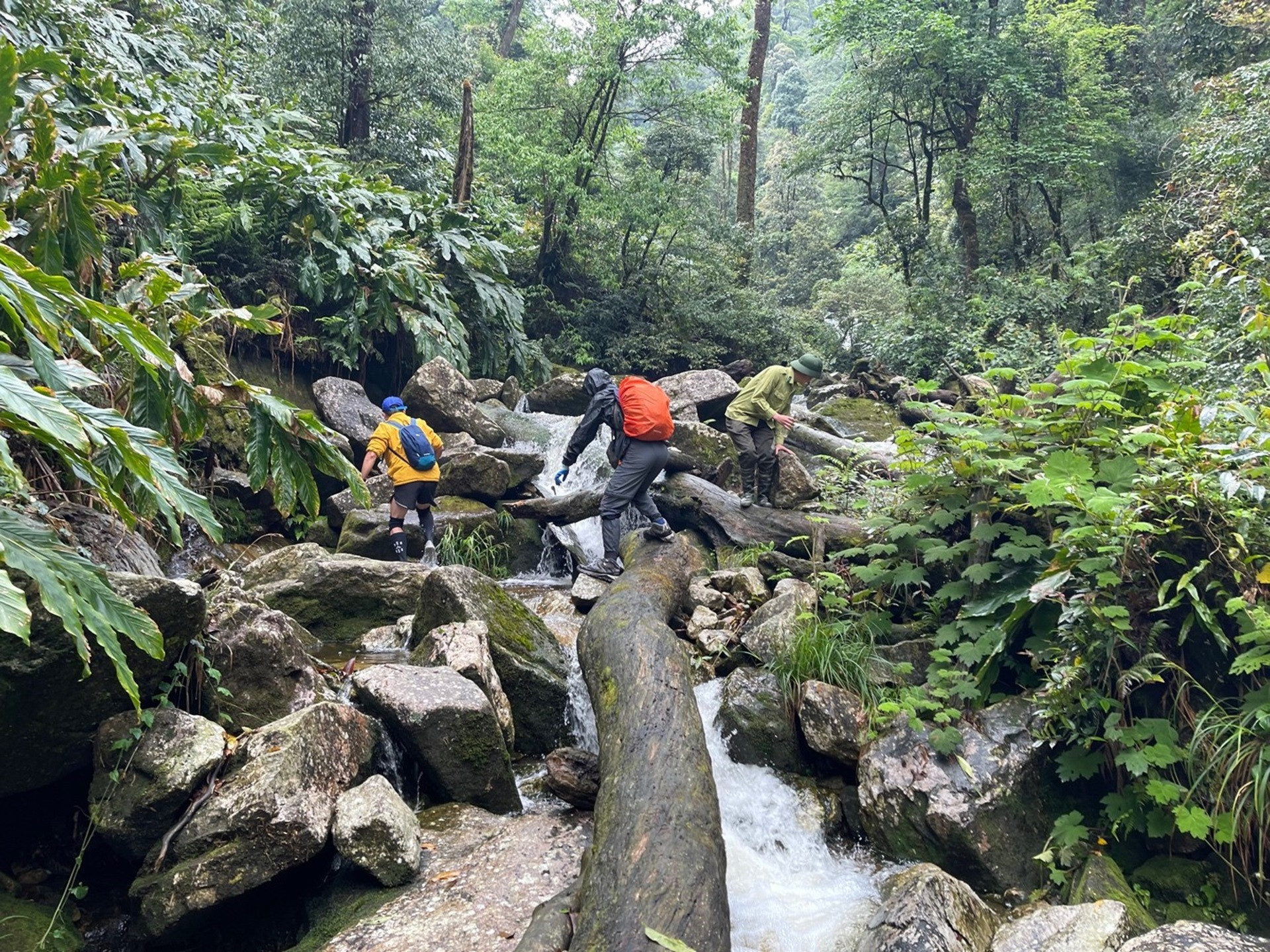
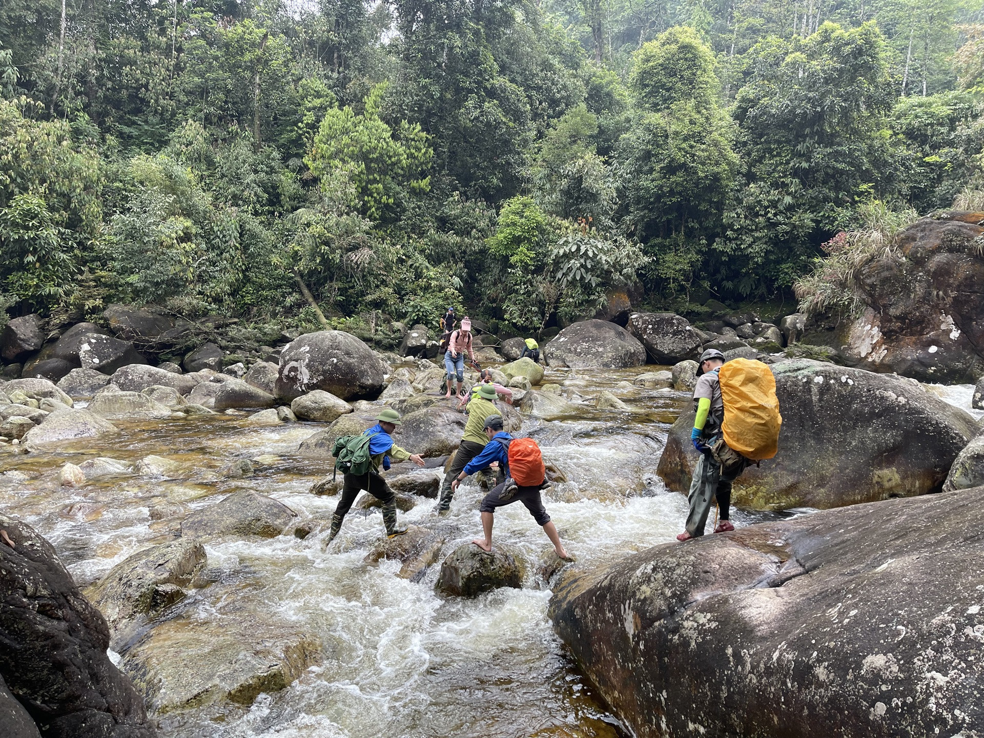
The road from the top of Nam Kang Ho Tao down the mountain towards Den Thao village, Lao Cai, crosses two large streams, if you don't stick close to each other it's easy to get lost. It's the dry season so the streams have little water but the rocks are full of slippery moss, it's easy to fall even if you're very careful.
Stone Stream on the Nam Kang Ho Tao climbing route is one of the largest streams in the Northwest. The stream bed is wide and the water flows very fast after each rain. The best way to cross large streams when climbing in the Northwest is to wear shoes that dry quickly and wade through the water. Do not go barefoot because it is easy to fall on slippery rocks.
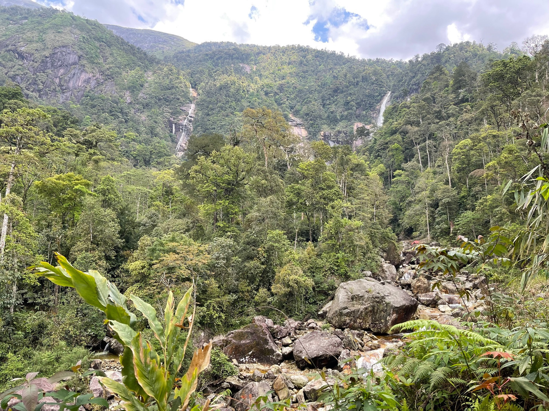
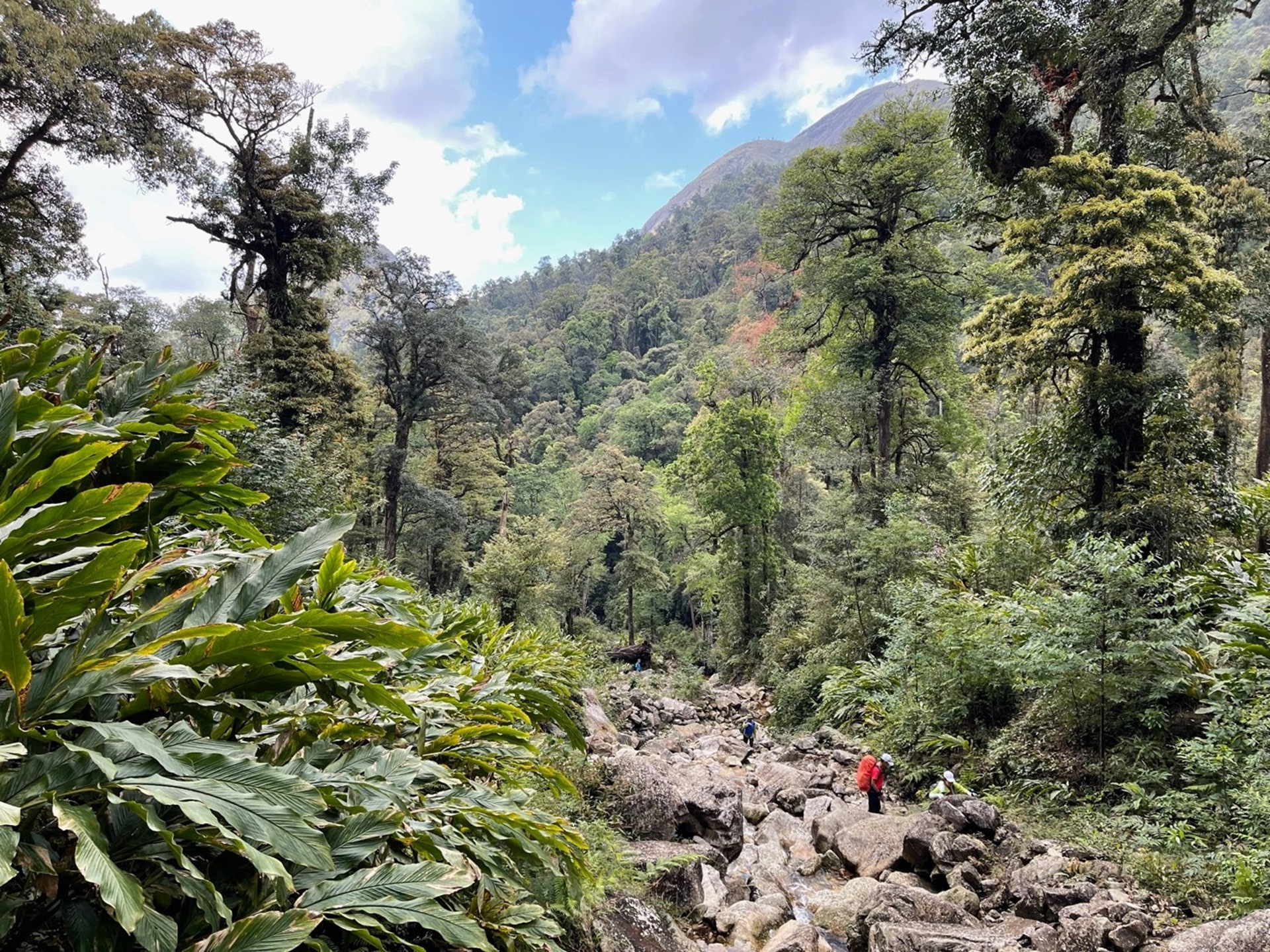
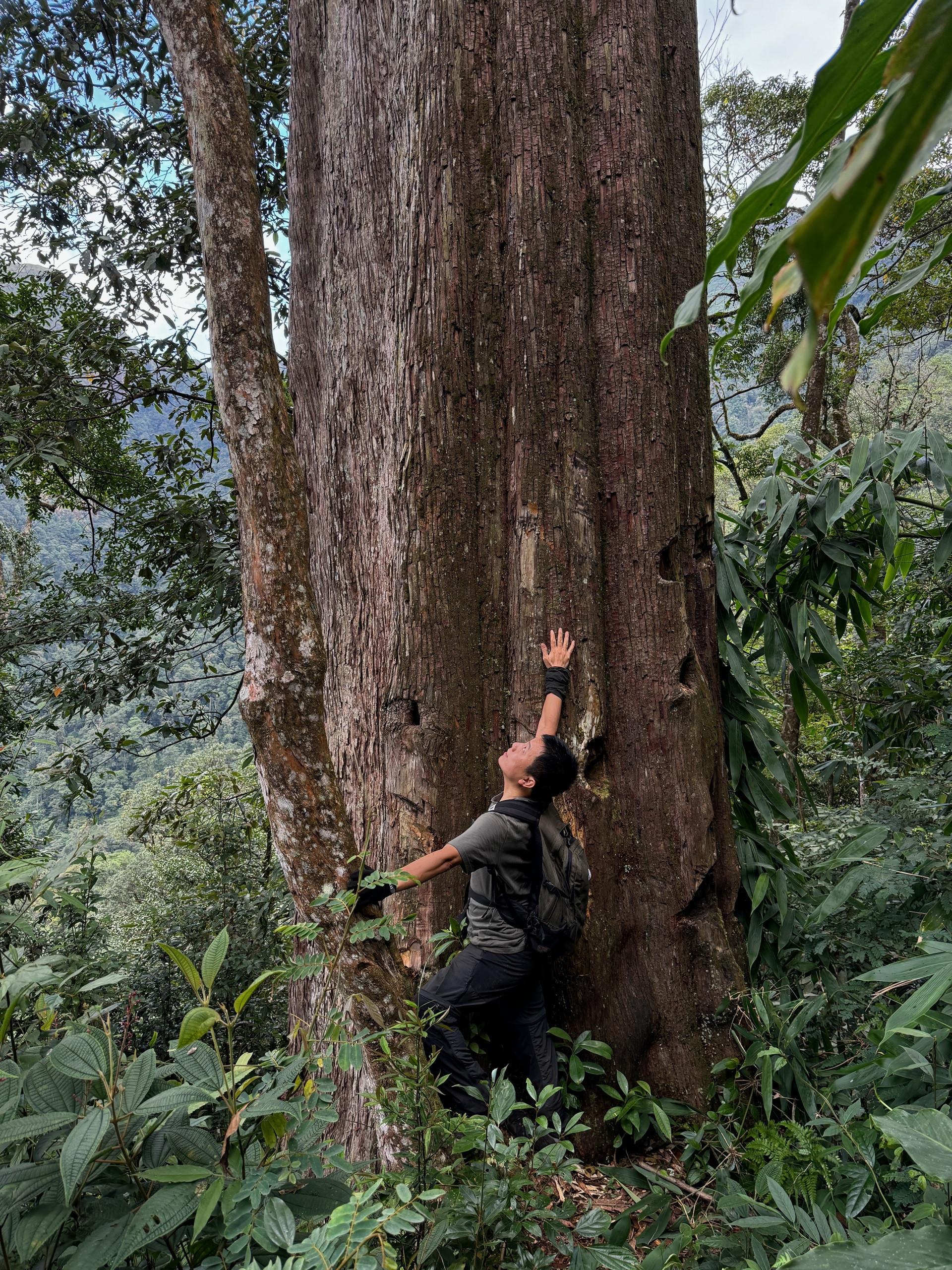
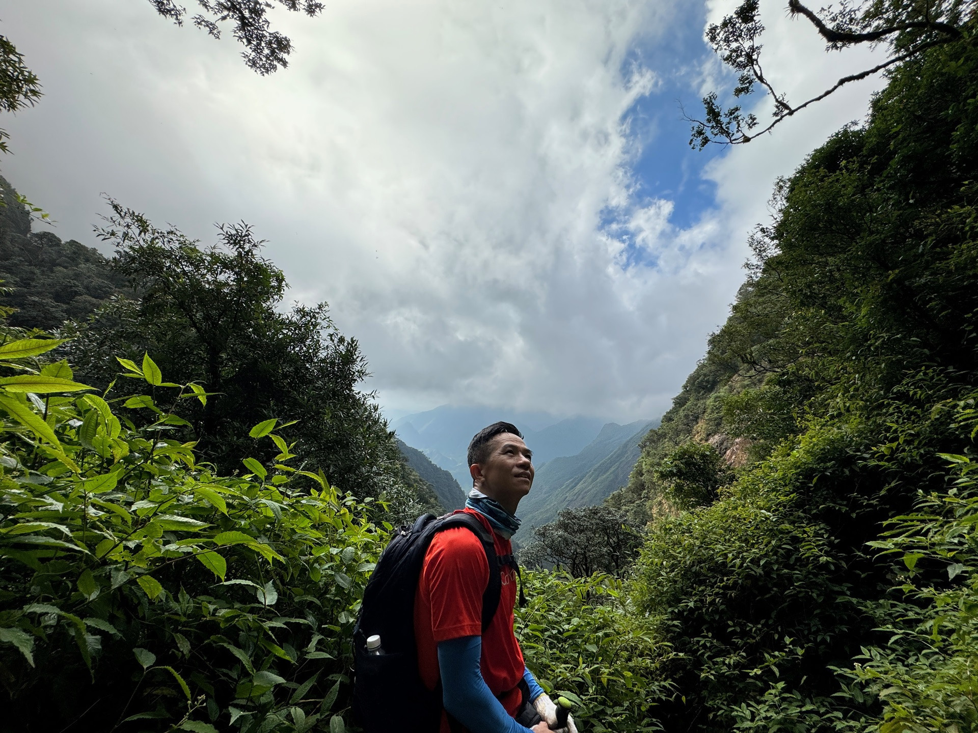
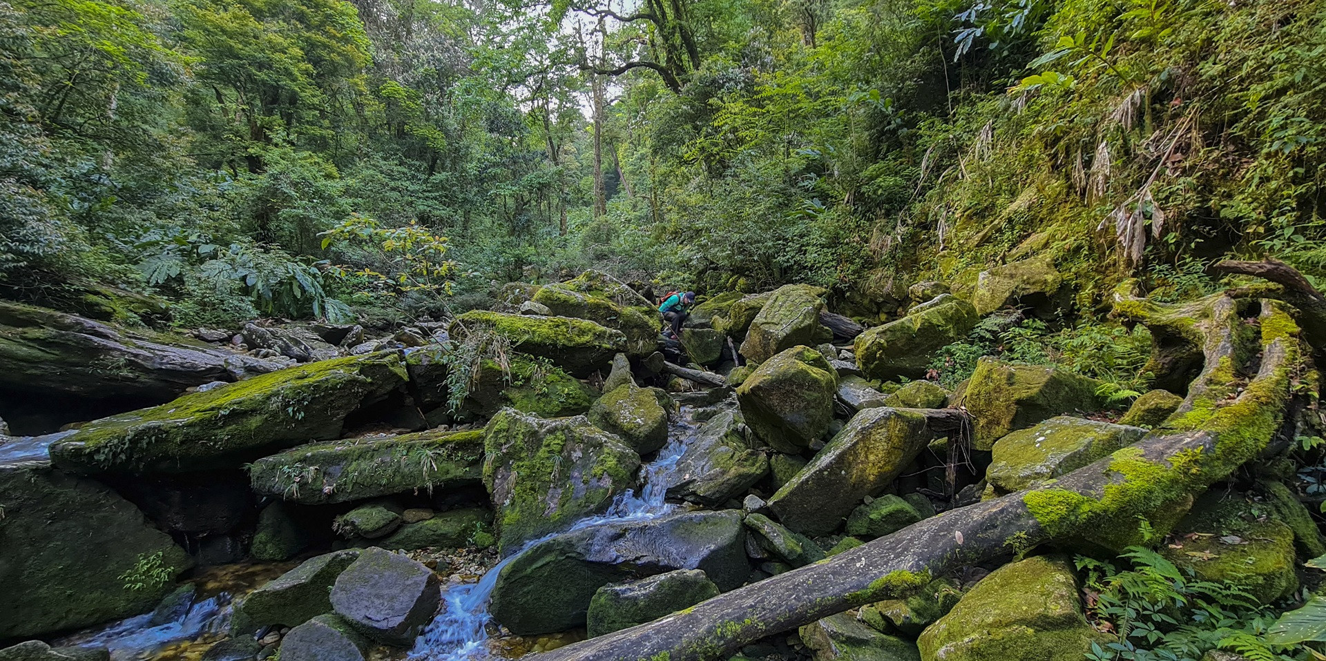
The primeval forest from the top of Nam Kang Ho Tao down to Lao Cai is considered the most beautiful forest in the Northwest. The poetic waterfalls and streams, cardamom growing abundantly below, above are rare trees such as green cypress, red pine, rhododendron, especially po mu, each tree has a diameter of more than 1m, making visitors feel like they are lost in a fairy garden.
The best time to climb Nam Kang Ho Tao is from October to the end of April when the weather is cool, the sky is in the dry season, there is little rain in the forest, avoiding the risk of flash floods or streams being flooded and becoming ferocious.
According to Vietnamnet