.gif "Bão số 3 vào Hà Nội, đã có 4 người chết, 78 người bị thương do bão")


.jpg "Real estate market in the south of Hai Duong city is bustling")

.jpg "Extremely dangerous forest fire risk in Kinh Mon, Chi Linh")


-ac017d3d3ce25d3405471795d6bb26f0.jpg "Gia Loc needs over 10 billion VND to invest in renovating and expanding landfills.")


Submit a comment
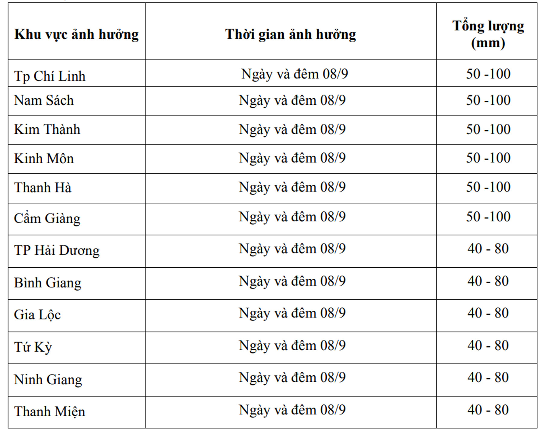
On the night of September 7, after moving deep into the Northern Delta region, storm No. 3 weakened into a tropical depression. It is forecasted that on September 8 and 9, the Hai Duong area will have moderate to heavy rain and thunderstorms.
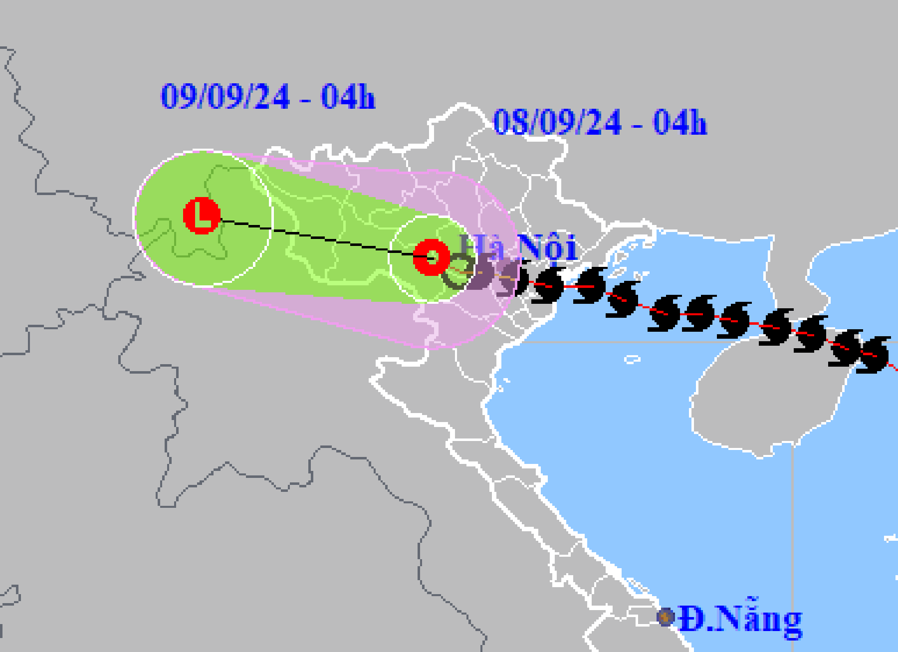
According to the National Center for Hydro-Meteorological Forecasting, at 4:00 a.m. on September 8, the center of the tropical depression was located at about 21.2 degrees north latitude; 104.8 degrees east longitude, on the mainland of the Northwest region. The strongest wind near the center of the tropical depression was level 6 (39-49 km/h), gusting to level 7, moving westward at a speed of 10-15 km/h.
It is forecasted that by 4:00 a.m. on September 9, the tropical depression will continue to weaken into a low pressure area over Upper Laos.
Due to the influence of storm No. 3 and tropical depression, Hai Duong area had heavy to very heavy rain, rainfall from 1:00 a.m. on September 7 to 1:00 a.m. on September 8 was generally from 100-150mm, in some places over 200mm.
Hai Duong Province Hydrometeorological Station forecasts that on September 8 and 9, Hai Duong will have moderate to heavy rain and thunderstorms. Thunderstorms may include tornadoes, lightning and strong gusts of wind. Rainfall will generally be 70 - 150mm, with some places exceeding 150mm.