


.jpg "The Lao Cai - Hanoi - Hai Phong Railway Project through Gia Loc uses nearly 44.3 hectares of land.")

")


.jpg "Kim Thanh reclaims more than 234 hectares of land to build an industrial park")


.jpg "Binh Giang's first quarter budget revenue reached nearly half of the province's annual target.")
.jpg "Early spring tea")

Submit a comment
No matter how imaginative you are, you cannot imagine that more than 200 years ago, Thanh Dong land was just a wasteland at the junction of the Sat River.
In the midst of many historical events, walking in Hai Duong City, where you have lived for many years, you still feel like a newcomer when standing in front of the buildings, roads, rows of trees, flower gardens, streets... as if a new shape has just appeared, wearing new colors, spreading new flavors.
From Le Palace to Dau Palace
According to historical documents, Hai Duong Thua Tuyen was established during the reign of King Le Thanh Tong, in the 10th year of Quang Thuan (1469). At that time, the administrative office was located in Mac Dong commune, Chi Linh, also known as Dinh Le, with Van citadel. But after nearly two centuries, the Le-Trinh dynasty entered a period of decline, the king and mandarins fought for power, the hungry farmers could not bear the hardship and rose up, including the uprising of Nguyen Cu and Nguyen Tuyen (at that time called a rebellion).
The insurgents occupied many areas, including Dinh Le. The court sent many military vehicles, elephants, and horses to "support", but still could not resist, so they had to abandon Dinh Le and move the headquarters to Mao Dien land in Cam Giang district today. That was the land on the bank of Van Dau river - a section of Sat river, so it was called Dinh Dau. Here there was also a ferry to Duong An land (now Binh Giang). In that position, people thought that if there was a problem, they could quickly ask for help from Thang Long and the post station was also convenient. From Dinh Dau, there was a crowded market, and Mao Dien Temple of Literature built on a high mound.
From Van Thanh to Dong Thanh
Nearly half a century later (in 1786), the Tay Son uprising army marched to Bac Ha, destroyed the Trinh feudal group, and the officers and soldiers in Dinh Dau also fled miserably.
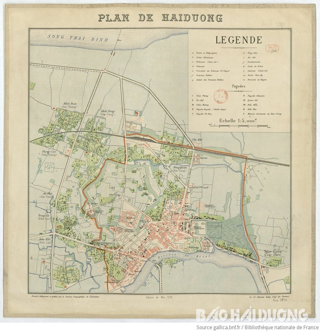
In the early 19th century, after Gia Long occupied Thang Long, a famous person from Duong An, Pham Dinh Ho (author of Vu Trung Tuy But), visited Dinh Dau. He observed the location and terrain and judged that if the capital of a province was only located near the Thanh Vien area, convenient for running the post, without worrying about future attacks and defenses, how could it control the mountains and seas and protect the land? In 1804, after occupying Bac Ha, the Nguyen Dynasty moved Dinh Dau from Mao Dien to the East, located at the confluence of Thai Binh River and Ke Sat River in Han village (called Han town). Here, the Nguyen Dynasty built a fairly solid citadel called Thanh Dong.
The Dong citadel was initially built with earth, reinforced with laterite in the 5th year of Minh Mang, and later added with Duong Ma citadel. The citadel has a regular hexagonal shape, with its edges forming zigzags. Outside the citadel there is a moat connecting to the Thai Binh and Sat rivers. The moat is over three truong wide and over half a truong deep (1 truong = 10 thuoc, 1 thuoc = 0.40m).
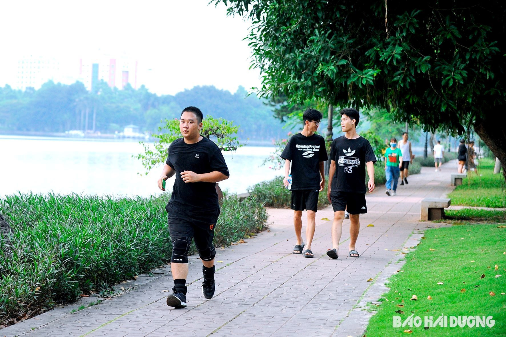
From swamp to beautiful green Hai Duong city
From Han wharf, Thai Binh river splits into a small branch, flows towards the train station, then Hang Be (Tam Giang) joins Sat river and flows to Cong Cau. Several villages in Ngoc Chau and Nhi Chau area now (formerly Cam Giang district) are like an island. After the French invasion, in order to exploit the colonial mineral resources and facilitate trade, in 1898, they built a railway connecting Hanoi and Hai Phong.
The process of building Phu Luong Bridge and the railway also “transformed” a section of the filled river into a road connecting the bridge to Highway 5 later. In the early 19th century, the Thai Binh River did not have a dike, so every year the rising water brought alluvium to fill it. By 1923, the section of the river between the two railways and Highway 5 had become a swamp, with only a small creek in the middle connecting to the city river to Thanh Dong. In 1985, to build the park, the land had to be dug up. Thus, a lake was created in the middle, gradually building and expanding the beautiful, poetic Bach Dang Park as it is today.
Hai Duong train station already existed, but at one time, passengers from the town had to take a detour from Quang Trung (half of Dong Thi Street, old Dong Giang) to the gate of To Hieu Primary School (old Nam Primary School) through An Ninh (old Ba Cua sewer) to reach the station. It was not until 1943-1944 that the last French consul in the province, Maximi, ordered the construction of a road from Bao Dai flower garden (today's Independence Square) to the station, 800m long. While the project was under construction, the Japanese coup that overthrew the French occurred. Then came the August Revolution in 1945.
After a while, the French occupied the town, so they turned the land used for the road into a place where planes took off and landed, calling it a “field airport”. After the war ended, the station was built spaciously, the road connecting to the station was invested in and built into a large, wide double-track road with a median strip, named after the revolutionary soldier Hong Quang.
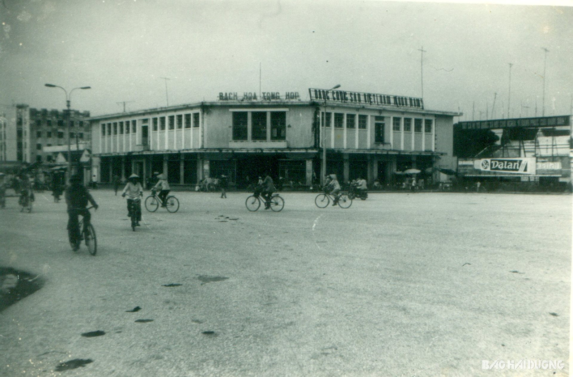
At the beginning of Hong Quang Street, the general store yard now, was formerly the Bao Dai flower garden (the last king of the Nguyen Dynasty). It was called a flower garden but it was only for officials, Westerners, and women to enjoy; poor people's children who entered were chased away by the police. Here, on the afternoon of August 17, 1945, a rally of tens of thousands of people inside and outside the city took place to respond to the August Revolution. Mr. Bach Nang Thi, the leader of the Viet Minh, stood on a high point, under the shadow of a large red flag with a yellow star, loudly reading the 10 policies of the Viet Minh Front, declaring the abolition of the puppet government, establishing a revolutionary government, and calling on the masses to support the revolutionary government.
Also here, on September 2, 1945, tens of thousands of people gathered to listen to the loudspeakers broadcasting President Ho Chi Minh's reading of the Declaration of Independence. Everyone raised their fists and shouted the five oaths of independence: Do not serve as soldiers for the French! Do not work for the French! Do not sell food to the French! Do not show the way to the French! Do not let the French invade our country a second time!
Since then, Bao Dai flower garden changed its name to "Independence Flower Garden".
Since the August Revolution, Hai Duong city, then Hai Duong town, has been constantly developing. In 1997, it was upgraded from a town to a city. In 2019, the Prime Minister decided to recognize the expanded Hai Duong city as meeting 5 criteria for a class I urban area.
NGUYEN THE TRUONG


.jpg "Hai Duong's agricultural, forestry and fishery value increased by 7.51% in the first quarter.")