


.jpg "Sạt lở đất đá vào khu ký túc xá ở Thanh Hóa, di dời khẩn cấp 214 học sinh")


")


.jpg "Kim Thanh reclaims more than 234 hectares of land to build an industrial park")


.jpg "Binh Giang's first quarter budget revenue reached nearly half of the province's annual target.")
.jpg "Early spring tea")

Submit a comment
Floods on the Thao River in Yen Bai have peaked and are receding. There is a risk of flash floods on small rivers and streams and landslides on steep slopes in some provinces of Ha Tinh and Quang Binh.
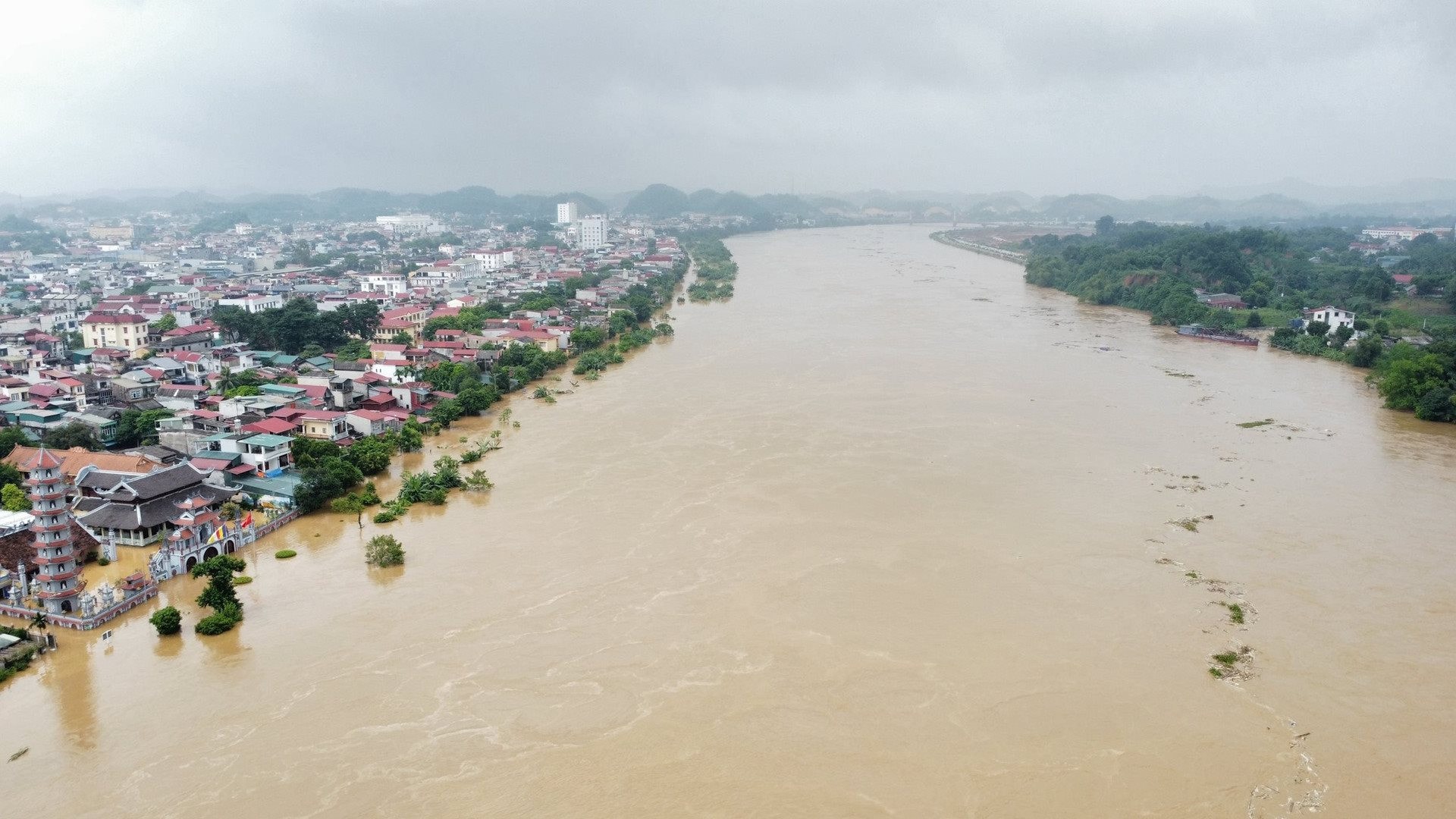
The flood on the Thao River in Yen Bai has peaked and is receding. At 11 p.m. on October 1, the flood peak at Yen Bai station was 31.71m, 0.29m below alert level III. At 1 a.m. on October 2, the water level at Yen Bai station was 31.64m, 0.36m below alert level III.
It is forecasted that in the next 6-12 hours, the flood on Thao River in Yen Bai will continue to decrease and be above alert level I. In the next 12-24 hours, the flood on Thao River in Yen Bai will continue to decrease below alert level I.
Flooding will gradually decrease in low-lying areas of Yen Ninh ward, Hong Ha ward, Minh Tan ward, Nguyen Thai Hoc ward, Nam Cuong ward, Dong Tam ward, Hop Minh ward, Tuy Loc commune, Au Lau commune (Yen Bai city), Co Phuc town, Quy Mong, Kien Thanh, Bao Dap, Viet Thanh (Tran Yen district), Yen Binh town (Yen Binh district), Mau A town, Mau Dong, Dong An, Dai Phac, Mo Vang, Vien Son, An Phu, An Thinh, Yen Hop (Van Yen district). There is a high risk of landslides in mountainous areas of Yen Bai province.
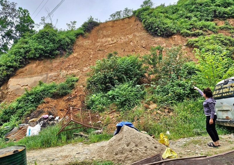
Meanwhile, in Ha Tinh and Quang Binh provinces, there has been moderate to heavy rain. It is forecasted that in the next 6 hours, there is a risk of flash floods on small rivers and streams, landslides on slopes in some Ha Tinh and Quang Binh provinces, especially in the districts of Duc Tho, Huong Khe, Huong Son, Ky Anh, Ky Anh town, Vu Quang; Bo Trach, Le Thuy, Minh Hoa, Quang Ninh, Quang Trach, Tuyen Hoa.
Flash floods and landslides can have very negative impacts on the environment, threaten people's lives; cause local traffic congestion, affect the movement of vehicles; destroy civil and economic works, causing damage to production and socio-economic activities.
PV


.jpg "Hai Duong's agricultural, forestry and fishery value increased by 7.51% in the first quarter.")