
.jpg "Tầm nhìn đến năm 2050 trong quy hoạch tỉnh Hải Dương")


.jpg "Seized a large amount of processed food without invoices or documents in Hai Duong City")

.jpg "Hai Duong handles 217 traffic violations in the first half day of the holiday")


.png "Podcast News April 30")


.jpg "Mother Buoi has husband and son who sacrificed for the Fatherland")


Submit a comment
Hai Duong has 4 spatial development axes according to the planning, including the economic development axis along the rivers. The future along the rivers is gradually opening up beautifully...
Clearly define development goals and advantages
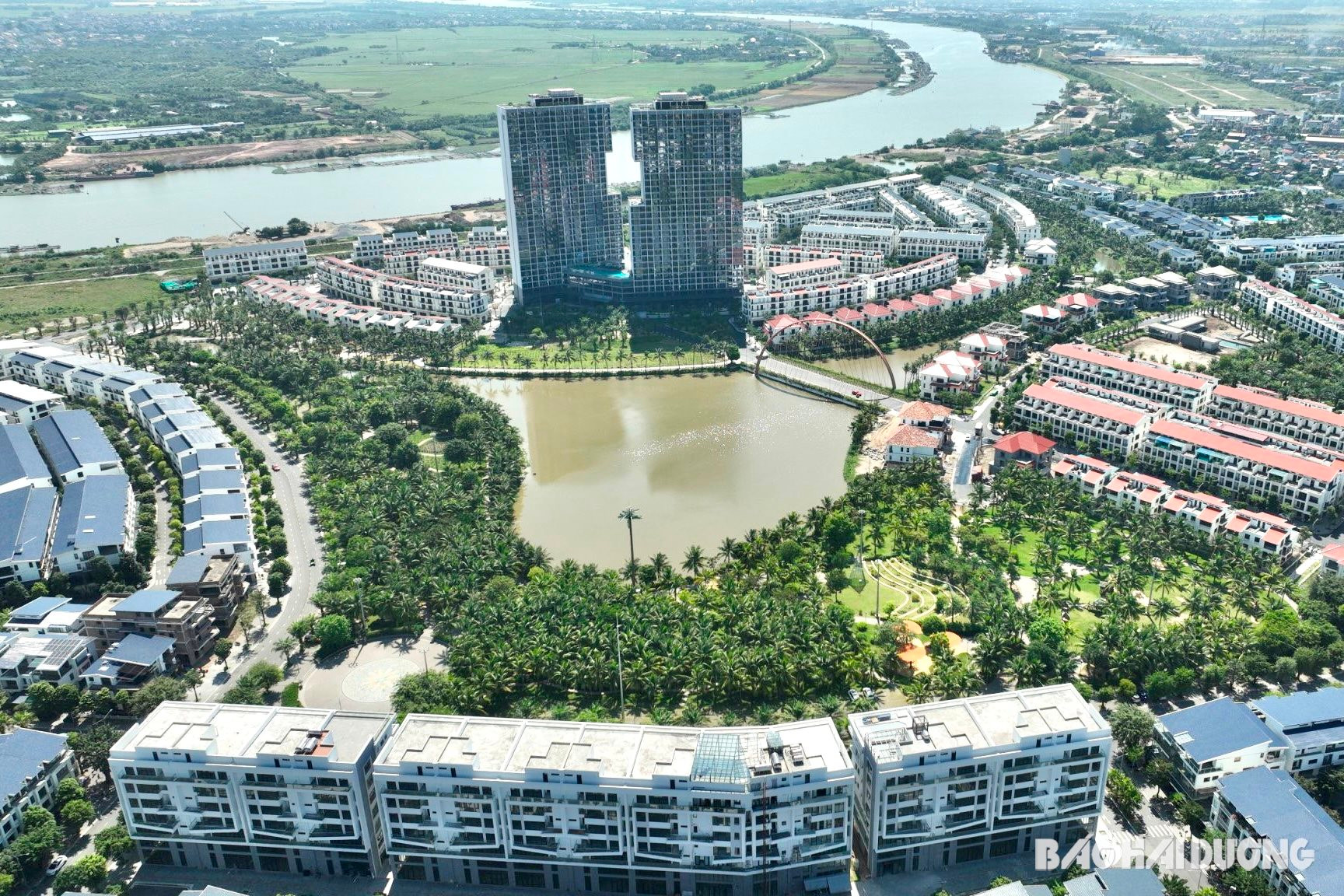
Hai Duong city seen from above, along the Thai Binh river winding like a soft silk strip, a prominent highlight is the ecological urban area along the Thai Binh river (Ecorivers). In addition to the rows of adjacent houses with sky blue or red tile roofs, the highlight is the Lighthouse twin towers. The tallest twin towers in Hai Duong province to date were inspired by the design of Hon Trong Mai of Ha Long Bay, 30 floors high. This is also a new urban area with a synchronous and modern technical and social infrastructure system in the direction of a typical ecological urban area of the province.
Urban development is one of the five strategic development pillars of Hai Duong, in which the province aims to promote the construction and development of urban areas in a green, modern, and smart direction to improve the quality of life of residents. The economic development axis along the rivers focuses on the axis along the Thai Binh River and the development of urban spaces associated with river spaces, in harmony with nature. In the future, Hai Duong will gradually complete the chain of urban spaces along the river banks. Urban spaces are oriented to develop along the Thai Binh River, Sat River, and Dinh Dao River. Thanh Ha and Tu Ky town areas will develop urban spaces approaching the water surface. In addition to urban public works, riverside residential areas can be developed...
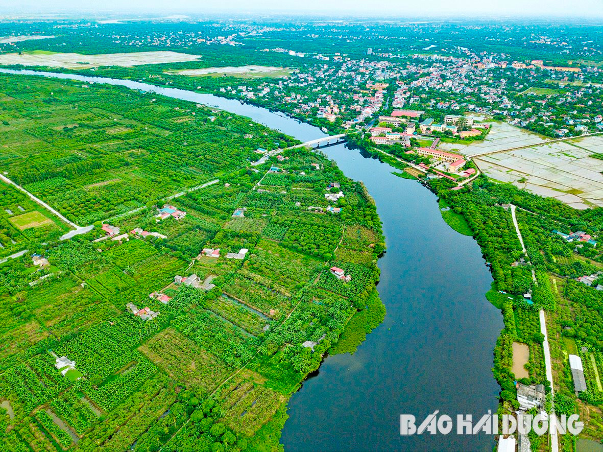
Mr. Pham Van Quyet, Head of the Department of Urban Planning and Development (Department of Construction) said that the river routes in the province have not yet fully exploited their advantages. To unleash the potential, there must be reasonable solutions, including solutions on planning new residential areas and urban areas associated with tourism development. In the past, the Department of Construction has advised the province on a number of solutions and planning options to concretize the socio-economic development associated with residential areas and urban areas along the river. Based on the approved provincial planning, in the coming time, the Department of Construction will coordinate with departments, branches and localities to continue advising the province to calculate the development of riverside urban areas in a reasonable and harmonious manner, ensuring the scale, landscape and effectively promoting the advantages of the river routes.
Step by step realization
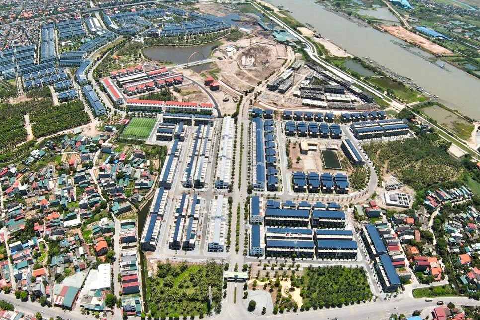
Currently, a number of residential areas and urban areas along the river in the province have been formed. In addition to Ecorivers, the new urban area across Han Bridge, covering an area of over 100 hectares in Minh Tan Commune (Nam Sach) and Thuong Dat Commune (Hai Duong City), has nearly 500 land lots eligible for transfer. This urban area borders the Thai Binh River and is being completed by the investor. In addition, there have been many ecological urban areas associated with rivers that have been included in the planning by the locality or proposed for planning by interested investors such as: residential area along the Sat River (Binh Giang); new residential area on the Huong River (Green River) in Hong Lac Commune (Thanh Ha); resort, ecological, sports and entertainment area at Vinh Tru Islet in Dong Lac Commune (Chi Linh); urban, resort, ecological, sports and entertainment area along the Thai Binh River (Hai Duong City); golf course complex, entertainment and ecological resort in the Soi area of Thai Binh River, etc.
According to Head of the Urban Management Department of Hai Duong City Vu Minh Nghia, after the adjustment of the general planning of Hai Duong City to 2040 was approved, the city has closely followed the objectives and tasks of the planning, reviewed the approved zoning plans and detailed plans, and at the same time developed zoning plans, detailed plans, and urban designs, in which priority was given to the implementation of key development areas. Currently, some plans have been approved. The city is implementing tasks to promote the strengths and potential of rivers, especially the Thai Binh River and the Sat River through the area, focusing on synchronously connecting infrastructure, creating conditions for the formation of new urban areas along the river.
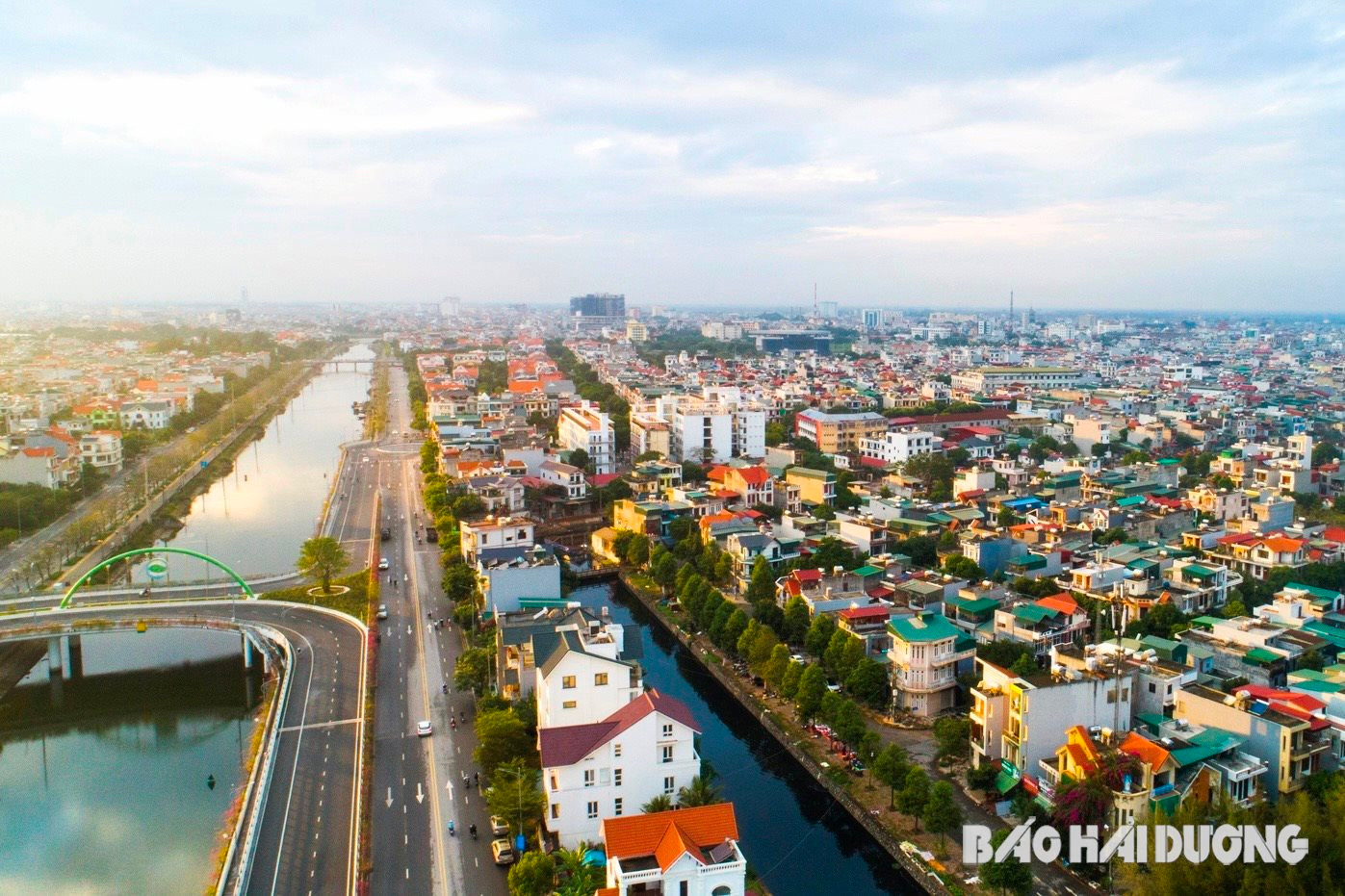
Then, along the rivers passing through Hai Duong, there will appear images of groups of tourists on boats admiring the beautiful scenery on both sides of the river with unique and impressive architectural works.
Final episode: Spreading out in all directions
PHAN ANH


