

.jpg "Hải Dương phát công điện ứng phó bão số 3")


Submit a comment
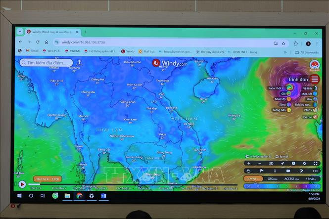
Faced with the complicated developments of storm No. 3 (international name YAGI), on the afternoon of September 4, the National Center for Hydro-Meteorological Forecasting held a meeting to share information with the press about the situation of this storm.
According to Mr. Hoang Phuc Lam, Deputy Director of the National Center for Hydro-Meteorological Forecasting, currently, storm No. 3 has strengthened to level 12-13, an increase of 4-5 levels compared to the initial information about the storm. The trajectory and increasing trend of the storm remain the same as previous reports of the National Center for Hydro-Meteorological Forecasting. Around the afternoon of September 6, storm No. 3 reached level 15-16, near the eastern area of Hainan Island (China). After that, due to friction and contact with Hainan Island and Leizhou Peninsula (China), the storm will weaken before entering the Gulf of Tonkin. The possibility of storm No. 3 entering the Gulf of Tonkin is very high, about 70-80%.
Assessing the reasons why storm No. 3 has continuously increased in intensity over the past 24 hours, Mr. Hoang Phuc Lam said that environmental conditions in the North East Sea are favorable for the development of the storm with a high temperature of 31 degrees Celsius maintained for many days. In addition, this area has not had a storm for a long time, so the accumulated energy, humidity, atmospheric circulation and pressure of the flow have continuously increased... According to Mr. Hoang Phuc Lam, the hot weather in the North and North Central regions is not a favorable condition for storm development but creates the risk of thunderstorms before the storm. It is forecasted that on the afternoon of September 6, when the storm is 400-500km from the mainland, the North and the capital Hanoi will have thunderstorms with lightning, concentrated in the Northeast.
Regarding the storm's developments, Mr. Hoang Phuc Lam said that around the night of September 6 to September 7, the storm will enter the northern part of the Gulf of Tonkin with wind intensity of level 12-13, gusting to level 15. The coastal areas of the North and North Central regions will have strong winds of level 10-11, gusting to level 12. From September 7 to 9, there will be a period of heavy to very heavy rain in the North and North Central regions. Quang Ninh, Hai Phong, Thai Binh, Nam Dinh, Ninh Binh are the 5 provinces and cities forecast to be most affected by the storm. Wind in coastal areas near the storm's center can reach level 9-11, gusting to level 13. Due to the storm's influence, from September 7 to 9, the Northern and North Central regions will have very heavy rain, with a high risk of flooding, flash floods, and landslides. Storm No. 3 is forecast to reach level 15, gusting to level 17, which is a super storm in the East Sea. When entering the Gulf of Tonkin, the storm passed Hainan Island and the north of Leizhou Peninsula (China), so it weakened and was no longer a super typhoon.
Storm No. 3 can be considered the strongest storm to enter the Gulf of Tonkin in the past 10 years. Its intensity and trajectory may be similar to the storms in 2014 and 2016. International meteorological stations share the same assessment with the Vietnam Meteorological Agency about the trajectory and trend of Storm No. 3, with a general intensity of level 15-17. From now until the end of the year, storms will peak in October, in September concentrated in the northern provinces; in October-November, storms will concentrate in the Central region, especially the Central Central region.
According to Mr. Dinh Huu Duong, Head of the Forecast Department of the Hydrometeorological Station of the Northern Delta and Midlands, due to the impact of storm No. 3, the sea waves in the area from Quang Ninh to Ha Tinh are at a height of 5-7m, the area near the storm center is from 7-10m; if the storm increases to level 15-16, it can be 10-12m high, causing danger to ships, including ships that have entered the anchorage area but have not taken thorough safety measures.
Regarding the impacts of storm No. 3 on Hanoi, Mr. Dinh Huu Duong said that it is expected that on September 7, Hanoi will begin to be affected by the storm. On the night of September 6 and the morning of September 7, this area will have winds of level 5-7; the strongest at level 7-9. On September 6, Hanoi is likely to have strong thunderstorms before the storm, occurring suddenly during the day, beware of falling trees, lightning, etc. In addition, heavy rain concentrated in a short period of time can overload the drainage system in the inner city, causing urban flooding and low-lying areas. The Tich, Ca Lo, and Bui river systems will have floods of 1-3m high, reappearing in flooded areas for many days in communes of Chuong My district.