
.jpg "Hải Dương phát công điện ứng phó bão số 3")


Submit a comment
On the morning of September 5, storm No. 3 (storm Yagi) continued to strengthen, reaching super typhoon level. Due to the storm's influence, from early morning of September 7, Hai Duong area had strong winds of level 5, level 6, then increased to level 7, level 8, gusting to level 9, level 10; heavy to very heavy rain and thunderstorms.
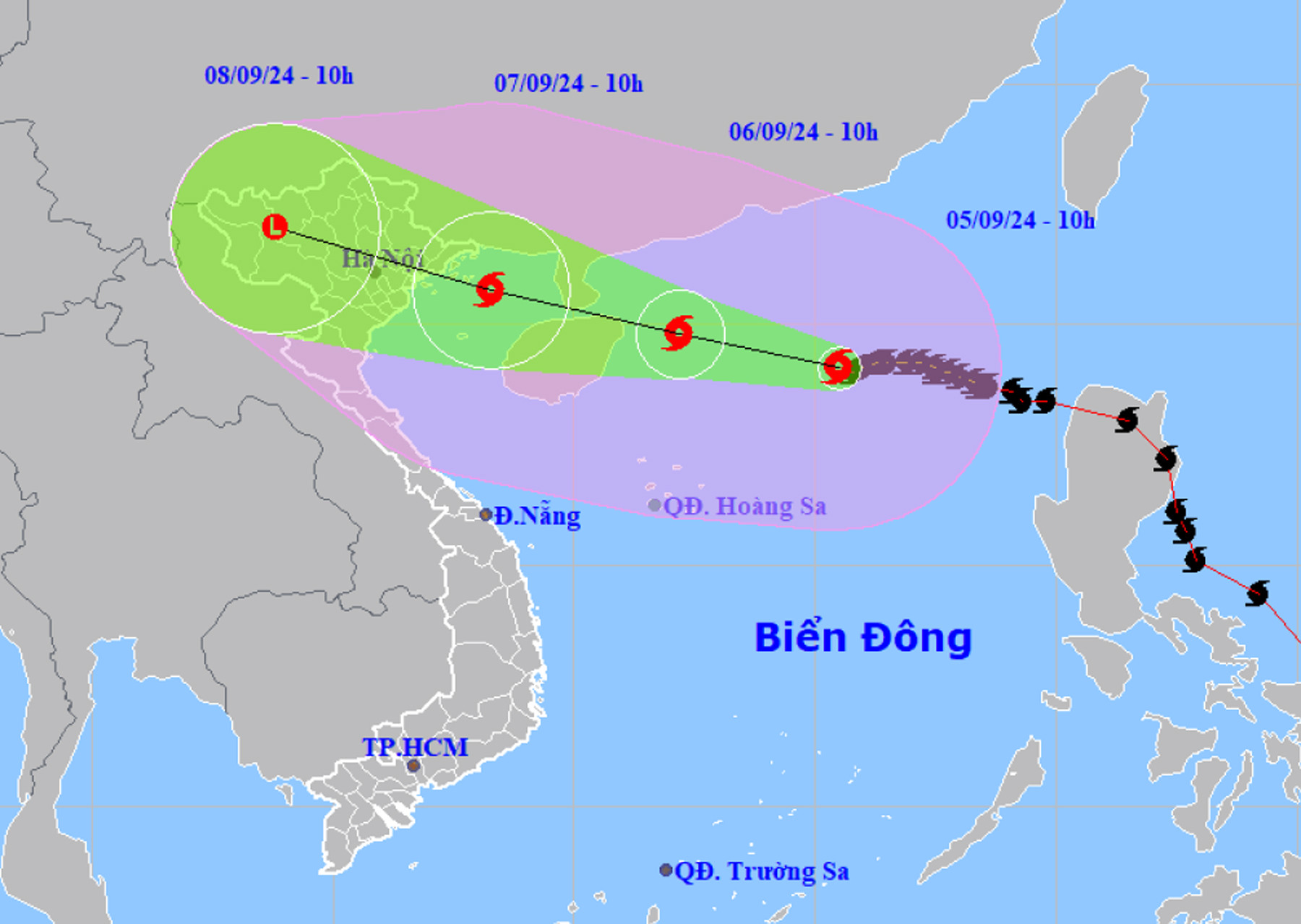
According to the National Center for Hydro-Meteorological Forecasting, at 10:00 a.m. on September 5, the center of storm No. 3 was located at about 19.1 degrees north latitude, 115.5 degrees east longitude, in the northern sea area of the North East Sea, about 490 km east of Hainan Island (China). The strongest wind near the center of the storm was level 16 (184-201 km/h), gusting to level 17, moving westward at a speed of about 10 km/h.
It is forecasted that in the next 24 hours, storm No. 3 will change direction, moving west-northwest, at a speed of about 10-15km/h. At 10:00 on September 6, the center of storm No. 3 will be about 550km east-southeast of Quang Ninh. The strongest wind near the center of the storm is level 16, gusting to level 17. At 10:00 on September 7, storm No. 3 will gradually weaken, reaching level 13, gusting to level 16, in the northern area of Bac Bo Gulf, about 120km east-southeast of Quang Ninh.
It is forecasted that in the next 48-72 hours, storm No. 3 will continue to move west-northwest, traveling about 20km per hour and gradually weaken into a low pressure area. At 10:00 on September 8, the low pressure area will be located in the Northwest region.
According to the Hai Duong Province Hydrometeorological Station, due to the impact of the storm, from early morning on September 7, Hai Duong area had strong winds of level 5, level 6, then increased to level 7, level 8, gusting to level 9, level 10. Strong winds can affect agricultural production, break trees, damage houses, traffic works and infrastructure. The level of natural disaster risk due to the storm is level 3.
From September 7-9, Hai Duong area will have heavy to very heavy rain and thunderstorms, with rainfall ranging from 200-350mm, with some places receiving over 350mm. Heavy rain can cause flooding in urban areas and low-lying areas; flash floods, landslides, especially in areas with steep terrain.
VN