Submit a comment
According to the provincial Hydrometeorological Station, from tonight, September 6, Hai Duong will have widespread heavy rain.

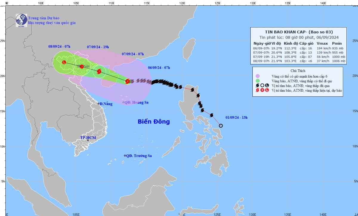
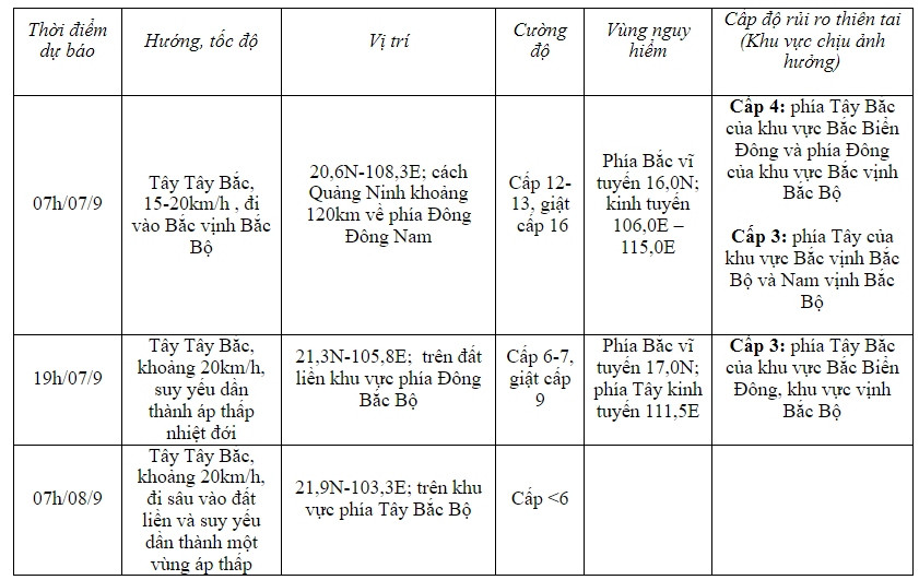
The weather forecast bulletin of the provincial Hydrometeorological Station on the morning of September 6 said that at 7:00 a.m. on September 6, the center of the super typhoon was at about 19.2 degrees North latitude; 112.3 degrees East longitude, in the northern sea area of the North East Sea, about 160km East Southeast of Hainan Island (China); about 600km East Southeast of Quang Ninh.
The strongest wind near the center of the super storm is level 16 (184-201km/h), gusting over level 17, moving west at a speed of 15-20km/h.

Forecast due to the impact of the storm at sea: The northwest sea area of the North East Sea has strong winds of level 11-14, the area near the center of the super storm has winds of level 15-16, gusting above level 17; the sea is very rough.
From around noon on September 6, the eastern sea area of the Gulf of Tonkin (including Bach Long Vi island district) will have winds gradually increasing to level 6-7. From the evening and night of September 6, the Gulf of Tonkin area (including Bach Long Vi island district and Co To) will have winds gradually increasing to level 8-9, then increasing to level 10-11, the area near the storm's eye will have winds of level 12-14, gusting to level 17; the sea will be very rough.
In Hai Duong,From tonight, September 6 to September 9, Hai Duong province will have heavy to very heavy rain and thunderstorms. Rainfall in Chi Linh city, Kinh Mon town and Kim Thanh, Nam Sach, Thanh Ha districts will be generally 200-300mm, with some places over 300mm.
The Southwest region of Hai Duong includes Cam Giang, Binh Giang, Thanh Mien, Gia Loc, Tu Ky, Ninh Giang districts and Hai Duong city with common rainfall of 250-350mm, in some places over 350mm.
Early September 7, Hai Duong area had strong winds of level 6, level 7, then increased to level 8, gusting to level 9, level 10. The strongest winds were from morning to evening of September 7.
Strong winds can affect agricultural production, break trees, damage houses, traffic works and infrastructure. Natural disaster risk level due to storm level 3.