


")

.jpg "11 big problems in science, technology, innovation and digital transformation of Hai Duong")


.jpeg "Difficult things should not be done carelessly.")


.jpg "Hai Duong traffic focus on May 10")


Submit a comment
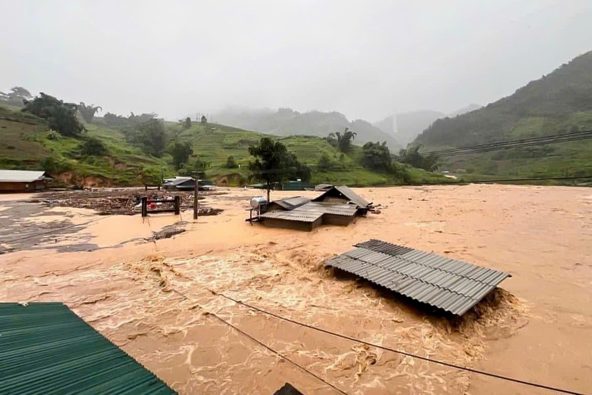
Following Typhoon Yagi, rising floodwaters caused deep inundation, landslides buried passenger cars, bridges collapsed, and traffic was paralyzed in Lao Cai, Yen Bai, Thai Nguyen, and Cao Bang.

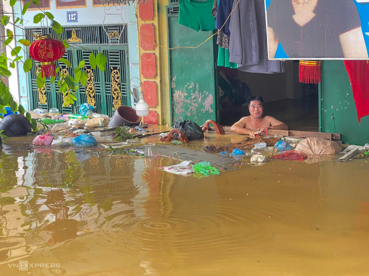
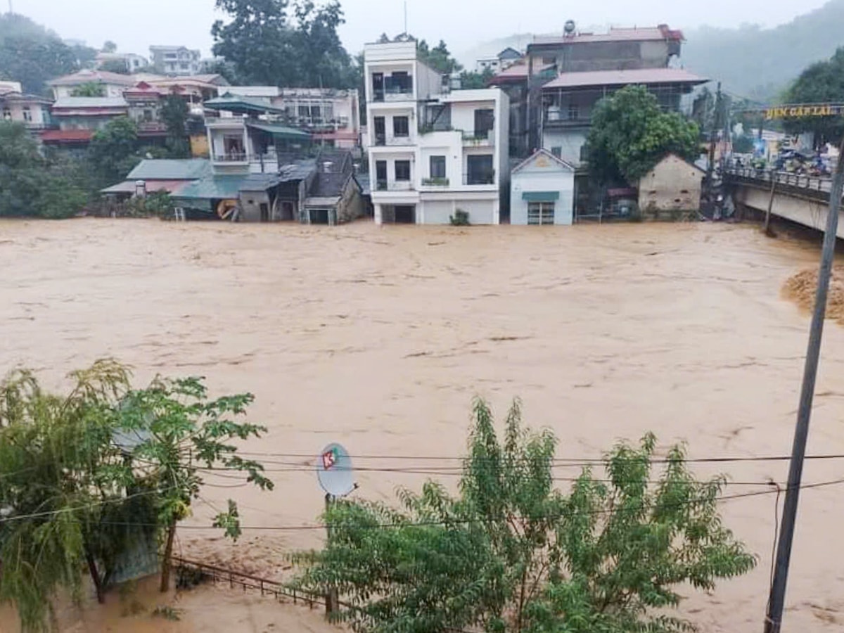
A corner of Trung Vuong ward, Thai Nguyen city, was heavily flooded due to rising floodwaters on the morning of September 9.
InThai Nguyen, the water level of Cau River at 4am was nearly 2.8m - 91cm higher than the third alarm. Last night, the province mobilized thousands of people to build dikes to prevent floods and evacuate people to safety. In Trung Vuong ward, Thai Nguyen city alone, the Cau River dike has 5 weak points that need to be reinforced. Hundreds of soldiers, police and people used soil in sacks to build the dike, but due to the rising water level, many sections have flooded into residential areas.
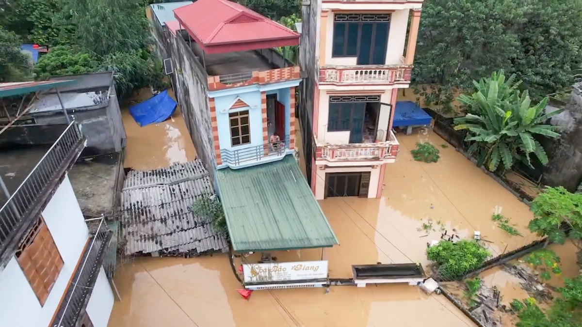
Water rose almost to the first floor of a high-rise building in Trung Vung ward, Thai Nguyen city, this morning.
The Thai Nguyen Steering Committee for Natural Disaster Prevention and Search and Rescue said that 55 wards and communes in Thai Nguyen City, Song Cong, Pho Yen, Phu Luong, Dong Hy, and Dinh Hoa districts were flooded. Authorities have urgently evacuated nearly 2,000 households.
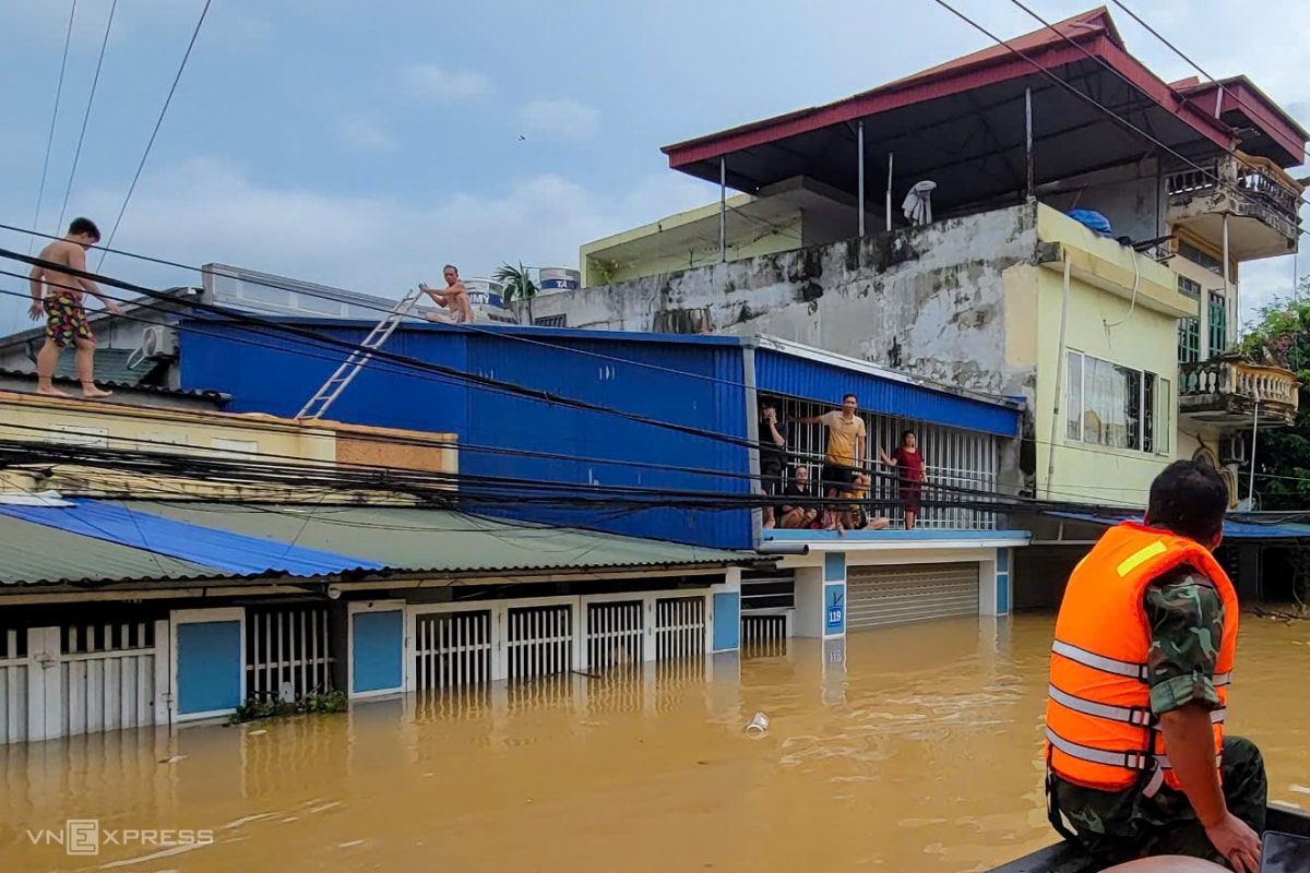
Floodwaters rose, residents of Vinh Quang ward, Thai Nguyen city climbed onto roofs to wait for rescue and evacuation.
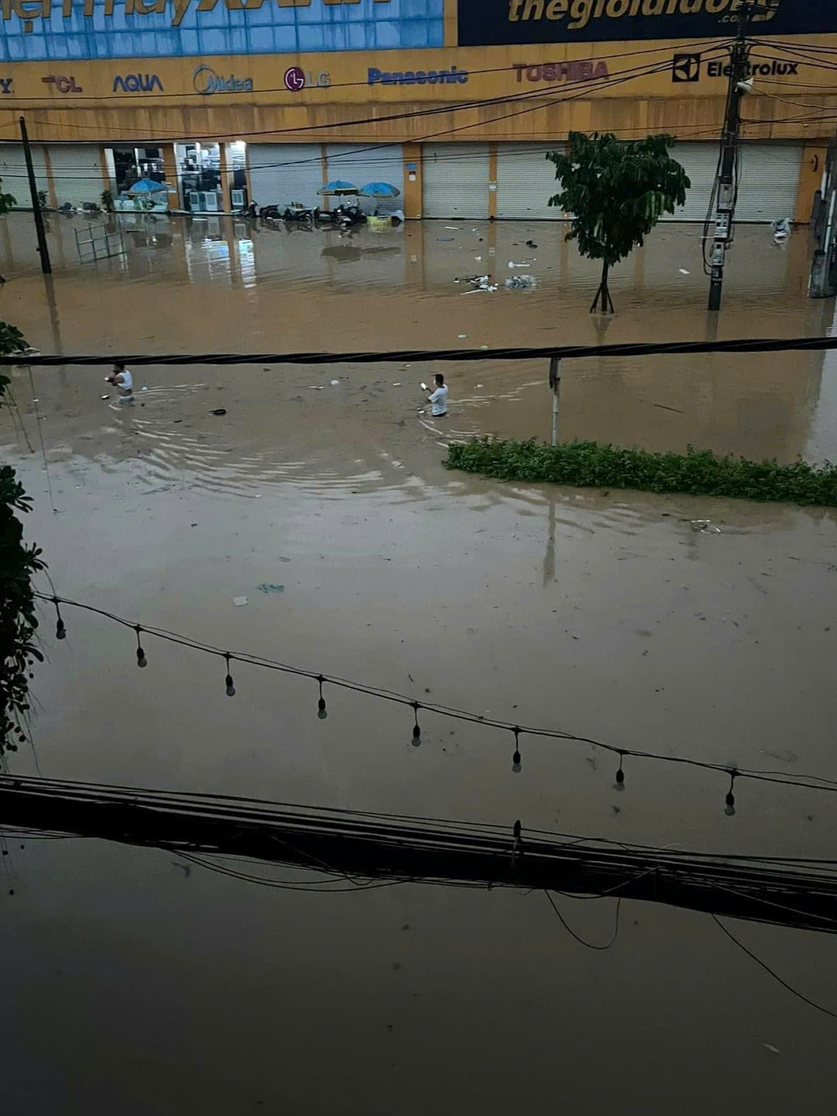
InYen Bai, the Red River water rose rapidly above alert level 3, causing many areas of Hong Ha and Nguyen Thai Hoc wards (Yen Bai City) to be waist-deep in water. Major roads such as Thanh Nien and Tran Hung Dao were flooded 1-2 meters deep, with water entering houses nearly a meter deep. Last night, hundreds of rescuers were sent to help people evacuate and move their belongings to higher ground.
Thanh Nien Street, Yen Bai City, is half-submerged in water. About 2,400 households had to be evacuated, with 1,452 households in Hong Ha Ward and 100 households in Nguyen Thai Hoc Ward. Traffic is currently congested due to rising river water, cutting off the market, Yen Bai station and the old bus station area.
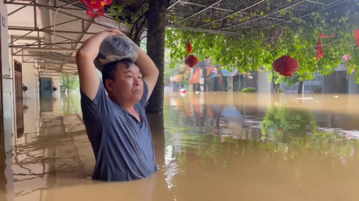
A house in Yen Bai City is flooded up to the chest, the homeowner waits for rescue forces to evacuate.

Yen Bai City authorities evacuated residents. This area is located next to the Red River, and the water level is currently over a meter high.
Floods in Yen Bai village
On the morning of September 9, the National Center for Hydro-Meteorological Forecasting said that due to the influence of the circulation after storm Yagi, many northern mountainous provinces are experiencing heavy rain from 7pm yesterday to 3am today. The rainfall in An Phu (Yen Bai) is 256mm, Gia Phu (Lao Cai) is nearly 160mm, Nam Dan (Ha Giang) is 153mm, Yen Do (Thai Nguyen) is 220mm.

Water rose high in Bao Ha temple area this morning. According to Hydrometeorological StationLao Cai,At 9:00 a.m., the Red River in Lao Cai City and Bao Ha Commune, Bao Yen District; the Chay River in Bao Yen District and the Nghia Do Stream in Vinh Yen Commune, Bao Yen District are experiencing complicated developments.
Floods on rivers and streams are forecast to continue to rise rapidly. The flood peak on the Red River at Bao Ha is likely to reach 61 m, 4 m above alert level three.
Authorities assist people in Lao Cai City in moving their belongings out of flooded areas.
Currently, many roads in Duyen Hai and Binh Minh wards, Lao Cai city are flooded by more than half a meter, vehicles cannot move. After 10am, authorities mobilized many forces to evacuate 72 households in Duyen Hai and Binh Minh wards from flooded areas, supporting the movement of assets and furniture to higher ground. Authorities have put up signs and stretched ropes to warn vehicles not to move through flooded roads to ensure safety.
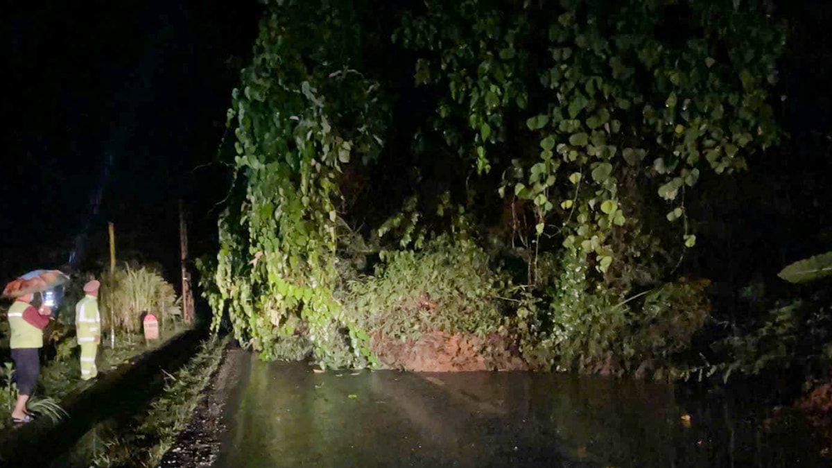
Rocks, soil, and trees fell onto National Highway 4D to Sa Pa, Lao Cai, paralyzing traffic in the early morning of September 9. The Chairman of Lao Cai Provincial People's Committee has declared a natural disaster emergency to deal with flash floods, landslides, and inundation in the province.
Rain map data in Lao Cai shows a red warning for almost the entire province, especially in Bao Yen, Bac Ha, Bat Xat, Sa Pa, Lao Cai city, where rainfall in 12 hours exceeded 100 mm, the highest reaching nearly 300 mm.
According to a quick report from Lao Cai Provincial People's Committee at 10:00 a.m., the natural disaster killed 14 people, injured 12 people (due to landslides); 50 houses were affected and damaged (19 houses in Sa Pa, 13 in Bao Thang, 18 in Van Ban). Many locations on national highways, provincial roads, and district roads were eroded; some irrigation works in Van Ban district were damaged.
Flood water poured into Bao Lac town,Cao Bang.
In Cao Bang City, heavy rain caused water from the Hien River to overflow onto Pho Cu Street, Hop Giang Ward at 1:30 a.m. on September 9, causing serious flooding. Many households had to evacuate urgently. Authorities quickly arrived to assist people in ensuring the safety of their lives and property.
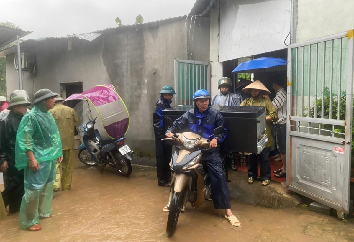
This morning, a passenger car traveling on National Highway 34 from Bao Lam District to Cao Bang City was buried by a landslide on the Ca Thanh Commune. At the time of the accident, there were 20 people on the car, including the driver and passengers (11 from Yen Lac Commune and 9 from Ca Thanh Commune, Nguyen Binh District).


.jpg "Hai Duong completed the target of each locality building 15 new houses for policy families, poor and near-poor households.")