

")
.jpeg "Hải Dương cho học sinh nghỉ học tránh bão số 3")


.jpg "Before the thunderstorm, Hai Duong continues to be hot and sunny")


.jpg "Reading culture in the digital age")


.jpg "What to see in Hai Duong newspaper on April 21?")


-a9f705f0fc2bb442b889e7ca8cfb4e9f.jpg "Prime Minister directs early payment of pensions in May")


.jpg "Parishioners joyfully celebrate Easter at Hai Duong Church")


Submit a comment
At nearly 3:00 p.m. on September 6, many areas of Hanoi were dark and had thunderstorms. The meteorological agency warned of tornadoes, lightning, and hail due to the influence of storm No. 3 (Yagi).
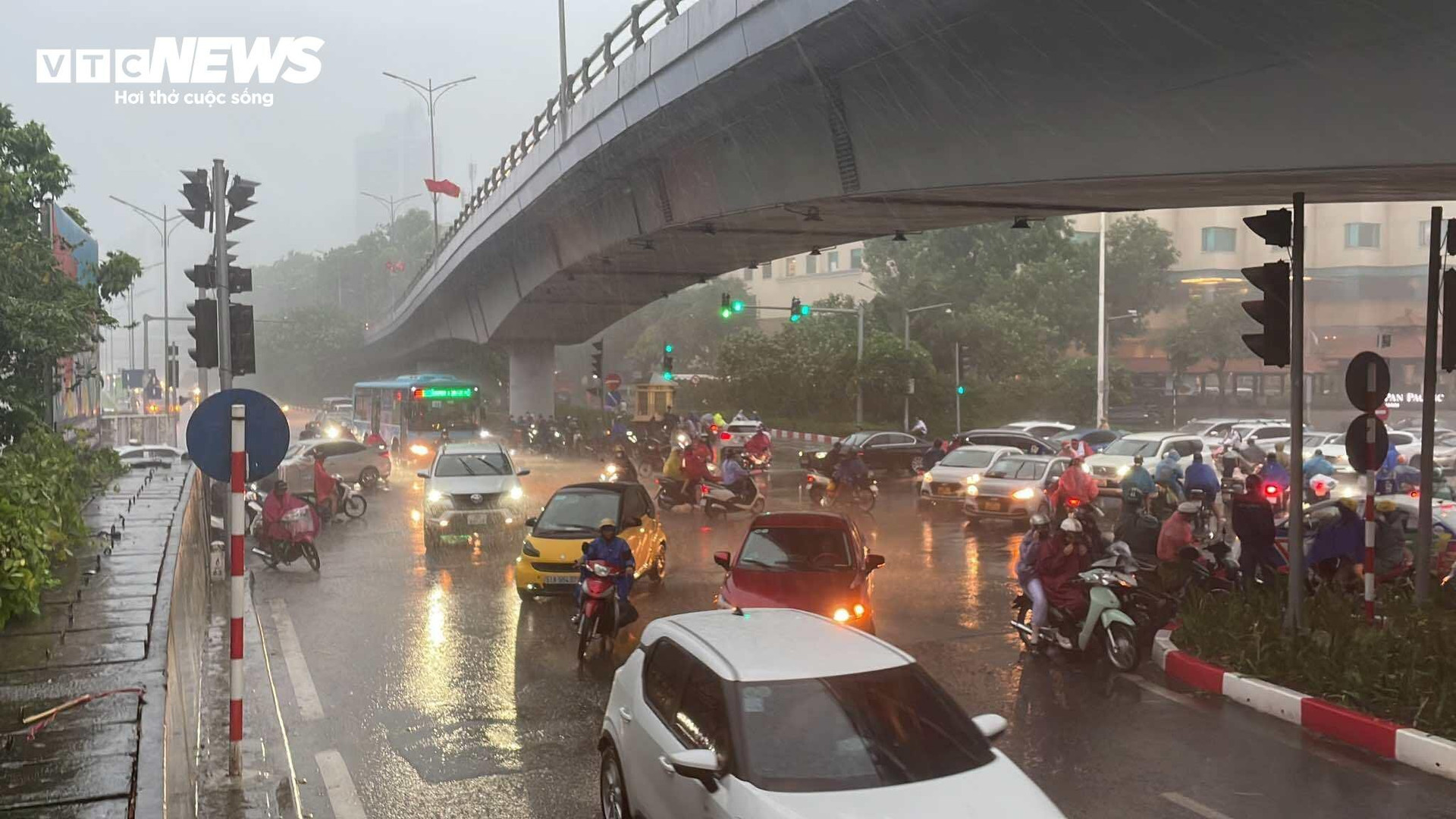
At around 3:00 p.m. on September 6, some areas in Long Bien, Hoang Mai, Tay Ho districts... started to rain with thunderstorms, lightning, and the sky darkened.
Ms. Lan in Long Bien district said that this afternoon she asked for leave from work to go home early to pick up her child to avoid super typhoon Yagi, but suddenly it rained heavily with a big thunderstorm, making it impossible for her to leave the house.
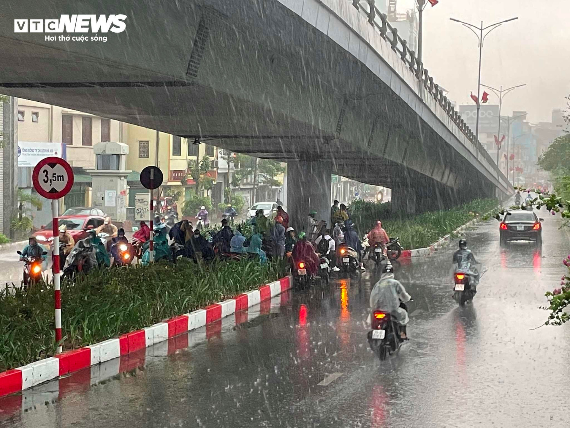
Meanwhile, Mr. Duc was riding his motorbike on Nghi Tam Street, Tay Ho District and had to stop under a bridge to avoid the storm.
At 14:45, the National Center for Hydro-Meteorological Forecasting issued a warning bulletin about thunderstorms, tornadoes, lightning, hail, and localized heavy rain in Hanoi's inner city.
Specifically, through satellite imagery, lightning location data and weather radar images, convective clouds have begun to form over Bac Ninh province. This cloud nest tends to move southwest and expand into the inner city of Hanoi.
The meteorological agency warns that in the next 3 hours, Tay Ho, Long Bien, Gia Lam districts will have showers and thunderstorms, then expand to other inner-city districts of Hanoi. During thunderstorms, there is a possibility of tornadoes, lightning and strong gusts of wind.
Warning level of natural disaster risk due to tornado, lightning, hail: level 1.
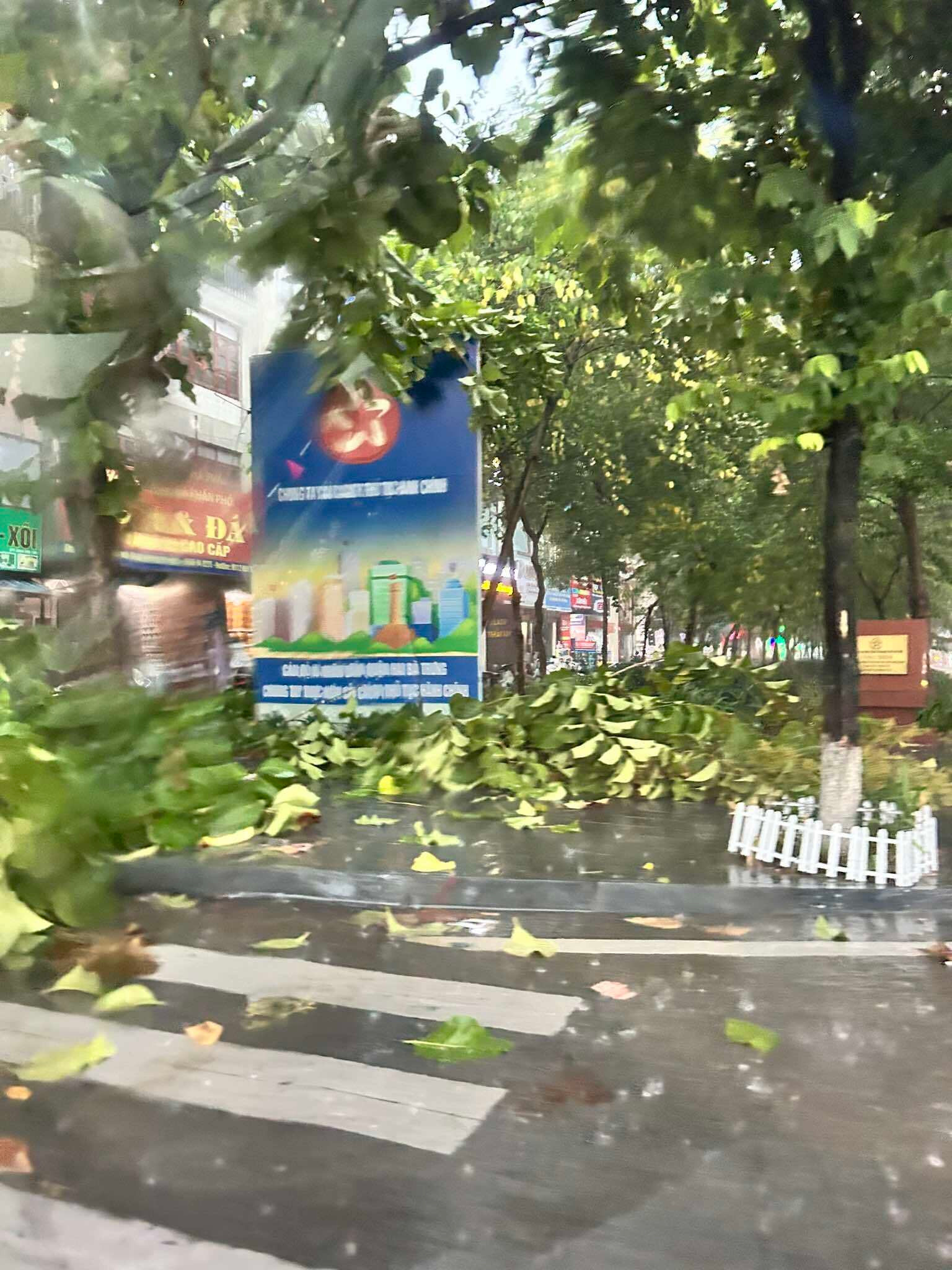
Signs and trees fell on Kim Nguu Street during a thunderstorm on the afternoon of September 6.
Previously, the meteorological agency issued a bulletin forecasting heavy rain in the North and Thanh Hoa. The bulletin said that this morning (September 6), the coastal areas of the Southern Delta and the North Central region will have showers and thunderstorms, with some heavy rain. The rainfall from 5am to 8am on September 6 was over 30mm in some places, such as: Xuan Thuy (Nam Dinh) 74mm, Dong Giao (Ninh Binh) 34.8mm, Ha Trung (Thanh Hoa) 33.6mm, Hoanh Son (Ha Tinh) 37.4mm,...
It is forecasted that from the night of September 6 to the night of September 7, the Northeast region and Thanh Hoa will have heavy to very heavy rain with common rainfall of 100-300mm, locally over 400mm.
During the day and night of September 7, the Northwest region will have heavy to very heavy rain with common rainfall of 70-150mm, locally over 200mm.
In addition, on the day and night of September 6, in the Central Highlands and the South, there will be rain, moderate rain and thunderstorms, locally heavy to very heavy rain with rainfall from 20-40mm, locally over 80mm (rain concentrated in the afternoon and evening). During thunderstorms, there is a possibility of tornadoes, lightning and strong gusts of wind.
The bulletin also noted that on the day and night of September 8, the North and Thanh Hoa will have moderate rain, some places will have heavy rain and thunderstorms with common rainfall of 20-60mm, some places will have over 90mm. Particularly, the Northwest and Viet Bac regions of the North will have heavy rain, some places will have very heavy rain with common rainfall of 50-150mm, some places will have over 250mm.
Heavy rain and localized heavy rain are likely to cause flooding in low-lying areas; flash floods on small rivers and streams, landslides on steep slopes (real-time warning information on areas at risk of flash floods and landslides is provided online on the website of the General Department of Hydrometeorology at: https://luquetsatlo.nchmf.gov.vn and in separate bulletins warning of flash floods and landslides).
HA (according to VTC News)