


.jpg "Hai Duong welcomes heavy rain after nearly 8 months")

.jpeg "Hai Duong heavy rain and thunderstorms")
.jpg "Hai Duong requests to close 49 full landfills")


.jpg "Invite you to read Hai Duong newspaper special issue")
.jpeg "People rush to complete real estate procedures before 'G hour'")


.jpg "Outstanding domestic and international events on April 25")

.jpg "Agree on proposal to exempt and support tuition fees for students")
.jpg "Woman in Bac Ninh illegally bought and sold invoices worth more than 6,000 billion VND")
.jpg "US President Donald Trump announced that Chinese President Xi Jinping had contacted")

.jpg "Noi Bai Airport is expected to welcome 108,000 passengers on the peak day of April 30.")

.jpg "Hai Duong Power conducts disaster prevention and incident response drills in 2025")

Submit a comment
The Department of Dyke Management and Natural Disaster Prevention and Control, Ministry of Agriculture and Rural Development, said that storm No. 4 injured one person; damaged 93 houses such as roofs blown off, walls collapsed; damaged 2 schools, roofs blown off; localized flooding of roads, and underground overflow at 16 traffic points.
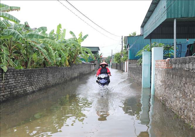
Localities have evacuated a total of 2,322 households; of which, 2,230 households were evacuated from areas at risk of flooding and 112 households were evacuated from areas at risk of landslides.
On the evening of September 19, the tropical depression (weakened from storm No. 4) weakened into a low pressure area over Central Laos.
It is forecasted that on the day and night of September 20, the areas of Southern Nghe An, Ha Tinh, and Quang Binh will have heavy to very heavy rain with common rainfall of 70-150 mm, some places over 250 mm. The areas of Thanh Hoa and Northern Nghe An will have moderate to heavy rain, some places very heavy rain and thunderstorms with common rainfall of 40-80 mm, some places over 150 mm. From September 21, heavy rain in the above areas will gradually decrease.
The midlands and deltas of the North, Phu Tho, and southern Son La will have scattered showers and thunderstorms, with some places experiencing heavy rain with rainfall of 15-30 mm, and some places experiencing over 60 mm. The Central Highlands and southern regions will have scattered showers and thunderstorms, with some places experiencing heavy rain with rainfall of 10-30 mm, and some places experiencing over 50 mm.
Natural disaster risk level due to heavy rain, tornado, lightning: level 1.
At sea, during the day and night of September 20, the sea area from Khanh Hoa to Ca Mau, Ca Mau to Kien Giang has strong southwest winds of level 6, gusting to level 7-8; the central East Sea area has winds of level 6, sometimes level 7 during the day, gusting to level 8-9; the southern East Sea area (including the sea area of Truong Sa archipelago) has winds of level 6, gusting to level 7-8, the wind gradually decreases at night; there are showers and thunderstorms, during thunderstorms there is a possibility of tornadoes and strong gusts of level 7-8. Natural disaster risk level due to strong winds at sea: level 2.
In the Central and Central Highlands regions, the flood on Gianh River (Quang Binh) is currently rising rapidly and is below alert level 2. In the next 12 hours, the flood on Gianh River will peak at alert level 2 and alert level 3, then decrease. There is a high risk of landslides in mountainous areas, riverbank landslides, localized flooding in low-lying areas along rivers and urban areas in Quang Binh province.
On September 19, there was no damage to the dikes due to the impact of rain and storm No. 4.
Regarding the situation of irrigation reservoirs, according to the Department of Irrigation, as of 5:00 p.m. on September 19, the capacity of reservoirs in the North Central region reached an average of 22-75% of the design capacity; in the South Central region, it reached 30-57% of the design capacity.
The Department of Dike Management and Natural Disaster Prevention and Control recommends that the provinces of the North, North Central, Central Highlands, and South deploy plans to respond to rain, especially the provinces from Thanh Hoa to Quang Binh to respond to very heavy rain and floods on rivers.

.jpg "The violator has removed the surrounding wall and iron net around the Bac Hung Hai bridge pillar.")