


.jpg "Gia Loc farmers turn squash, luffa... into commercial crops")
.jpg "The event 'Hai Duong litchi season' is expected to be held at the end of May.")

.jpg "'Forest man' in Bai Thao (Chi Linh)")

.jpg "The income of Cam Giang people is nearly double compared to the time when they achieved new rural standards.")

.jpg "Invite you to read Hai Duong newspaper special issue")
.jpeg "People rush to complete real estate procedures before 'G hour'")


.jpg "Outstanding domestic and international events on April 25")

.jpg "Agree on proposal to exempt and support tuition fees for students")
.jpg "Woman in Bac Ninh illegally bought and sold invoices worth more than 6,000 billion VND")
.jpg "US President Donald Trump announced that Chinese President Xi Jinping had contacted")

.jpg "Noi Bai Airport is expected to welcome 108,000 passengers on the peak day of April 30.")

.jpg "Hai Duong Power conducts disaster prevention and incident response drills in 2025")

Submit a comment
The landslide area on the right bank of Van Uc River in Thanh Cuong Commune, Thanh Ha District (Hai Duong) has been promptly handled.
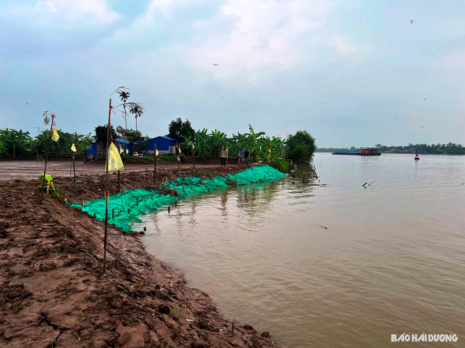
According to the Steering Committee for Natural Disaster Prevention and Search and Rescue of Hai Duong province, a landslide occurred in the Van Uc riverbank area in Thanh Cuong commune (Thanh Ha). The landslide is 28 m long, encroaching on the bank by 6 m, and is 3 m deep compared to the current bank surface. The landslide area is nearly 170 m2.2, the nearest point is 62 m from the foot of the dike. This is the beach area that people have renovated to exploit sandworms.
The cause of the landslide was determined to be due to the weak geological foundation of the beach, mainly alluvial soil mixed with sand on the riverbank. The flood caused by the impact of storm No. 2 at the end of July combined with the impact of high tides caused the riverbank erosion. The landslide started at the end of July, and it is estimated that this area will continue to erode and encroach deeper into the shore in the coming time.
The Thanh Ha District Steering Committee for Natural Disaster Prevention and Search and Rescue has set up monitoring poles, used nets, and planted bamboo stakes to limit landslides and warn of danger. At the same time, it has arranged a permanent force to guard the landslide area, and prepared supplies and equipment to be ready to handle urgent situations.
STRONG phản ảnh bờ kè sông Luộc và kênh qua đê Đại Hà sạt lở")

.jpg "The violator has removed the surrounding wall and iron net around the Bac Hung Hai bridge pillar.")