


Submit a comment
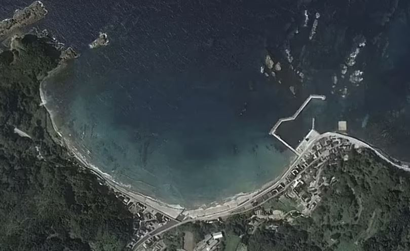
Satellite images show that the January 1 earthquake moved Japan's coastline by more than 250 meters.
On the first day of 2024, a 7.6 magnitude earthquake struck Japan, triggering a massive tsunami warning. As of January 12, the disaster had claimed 213 lives and forced 26,000 to evacuate.
Recently, satellite images taken from above have revealed further evidence of the incredible power of this earthquake.
Shocking images show the coastline moved more than 250 metres seaward. On the Noto peninsula, the tremors lifted a new beach the size of two football pitches out of the water and left harbours dry.
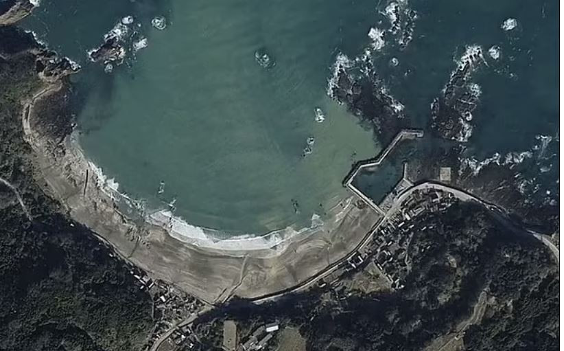
That's not the only place that has expanded since the earthquake. Sand banks have also risen significantly at more than 10 locations along the East Asian nation's coastline.
Because earthquakes occur so frequently, Japan has the world's most sensitive seismic detection network. A network of GPS stations at strategic points across the country record ground movement after each earthquake.
In the case of January 1, the land-recording system moved up to 130cm to the west.
Satellite images also reveal that land is rising across Japan, particularly on the west coast of the Noto Peninsula.
In some places, the ground was raised up to 4 meters and shifted 1 meter.
Notably, the sudden increase in land elevation may have reduced the impact of the tsunami caused by the earthquake.
The University of Tokyo reported evidence of waves 1.4 to 2.6 meters high on the Noto Peninsula.
The ground in the affected area is now so loose that even a small rainstorm can cause landslides, even flattening entire residential areas.
Japan was rocked by a magnitude 6 earthquake last week, causing widespread devastation. The tremor struck in the same area that was hit hard by the January 1 earthquake.
TH (according to Tin Tuc newspaper)