


.jpg "Before the thunderstorm, Hai Duong continues to be hot and sunny")


.jpg "Reading culture in the digital age")


.jpg "What to see in Hai Duong newspaper on April 21?")


-a9f705f0fc2bb442b889e7ca8cfb4e9f.jpg "Prime Minister directs early payment of pensions in May")


.jpg "Parishioners joyfully celebrate Easter at Hai Duong Church")


Submit a comment
Forecasts indicate that there are only two low pressure areas in the East Sea, one of which is in the Gulf of Tonkin, very close to our country. Warnings of thunderstorms across the country, with heavy rains in many places.
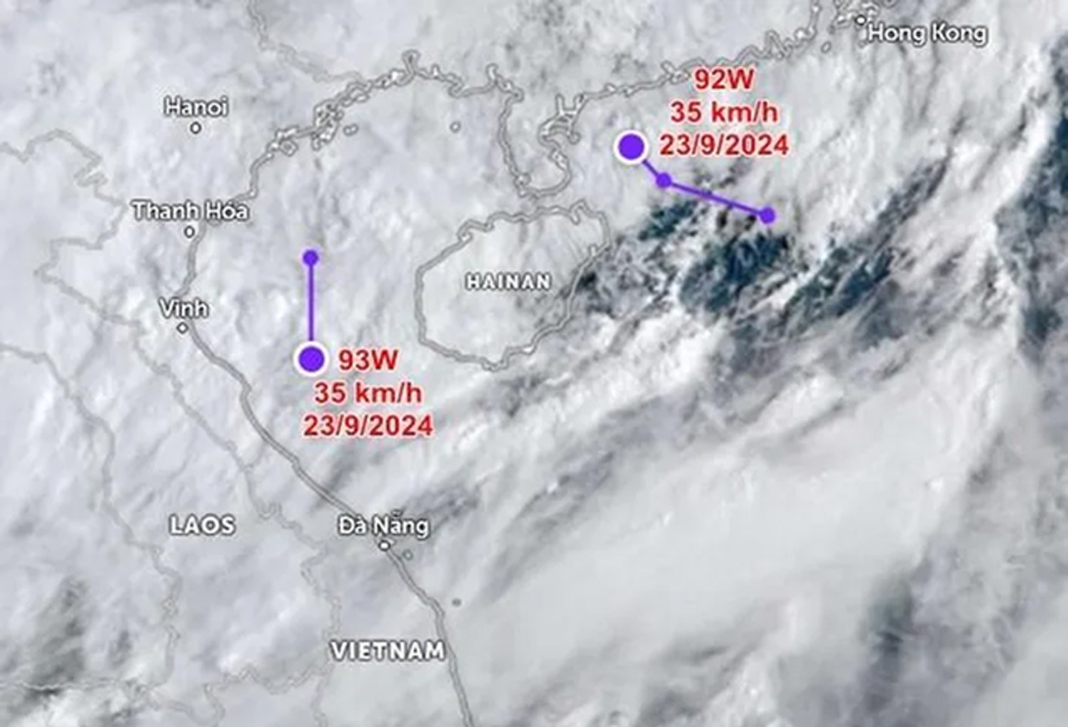
According to the National Center for Hydro-Meteorological Forecasting, from the evening of September 22 to the early morning of September 23, two new low pressure areas appeared in the East Sea, denoted as 92W and 93W.
At 7:00 a.m. on September 23, low pressure 92W near Hainan Island (China) had its strongest wind speed increased to 35 km/h (30 km/h on the night of September 22). This low pressure is moving in a West-Northwest direction, towards the South of China. The US Joint Typhoon Warning Center (JTWC) assessed that the possibility of 92W strengthening into a tropical depression or storm in the next 24 hours is low, possibly partly because it is very close to the mainland and does not have conditions to develop much.
More notably, low pressure 93W appeared right in the Gulf of Tonkin and was confirmed by JTWC to be near our country. The strongest sustained wind speed of low pressure 93W is 35 km/h. From early this morning, September 23, the low pressure is moving south, with the possibility of approaching the central region of our country.
JTWC forecasts that the possibility of low pressure 93W developing into a tropical depression or storm in the next 24 hours is also low. However, a low pressure/disturbed weather area can also affect the weather at sea and on land, and extreme weather events are becoming increasingly unpredictable, so low pressure 93W is being monitored by meteorological agencies.