


.jpg "Hai Duong is hot before thunderstorms")
.jpg "Dark clouds gather in many places in Hai Duong, beware of thunderstorms and hail")


.jpg "Hai Duong took 33 samples of medicine, milk and functional foods for quality testing.")
.jpg "Be cautious about 'surfing' real estate before merging Hai Duong and Hai Phong")


.jpg "Thai Tan village (Nam Sach) is green from house to alley")


.jpg "Number of newly established enterprises in Hai Duong increased by 21.3%")


Submit a comment
A tropical depression is active east of the Philippines and is forecast to strengthen into a storm, with a 60-70% chance of entering the North East Sea next week.
Currently (September 29), there is an active tropical depression east of the Philippines. In the next 24-48 hours, the tropical depression may strengthen into a storm but is unlikely to enter the East Sea.
From around October 4-6, the storm is likely to move into the North East Sea with a probability of 60-70%.
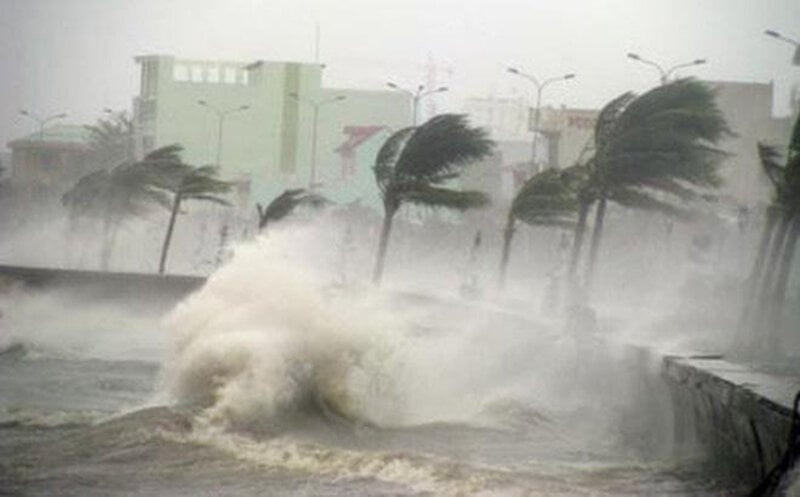
Storms may appear in the East Sea next week (illustrative photo)
Previously, the National Center for Hydro-Meteorological Forecasting said that on the afternoon of September 24, a low pressure area in the sea southeast of the Hoang Sa archipelago had strengthened into a tropical depression. On the night of September 25, after moving into the coastal area of Quang Tri - Da Nang, the tropical depression intensity was level 6, gusting to level 8, then moved inland in the provinces of Quang Tri - Thua Thien Hue and quickly weakened into a low pressure area, causing widespread heavy rain.
According to the report of the Standing Office of the National Steering Committee for Natural Disaster Prevention and Control, from 7:00 p.m. on September 24 to 7:00 p.m. on September 28, the North Central region had widespread rain of 300-400 mm, concentrated on September 26-27. Some stations had heavier rain such as: Thanh Thuy (Nghe An) 505 mm, Hanh Lam (Nghe An) 493 mm, Border Guard Station 571 (Ha Tinh) 580 mm, Ho Ho (Ha Tinh) 553 mm, Dan Hoa (Quang Binh) 581 mm, Tuyen Hoa (Quang Binh) 459 mm.
In the North, from 7:00 p.m. on September 26 to 7:00 p.m. on September 28, the rain was generally 150-250 mm, concentrated on September 28. Some stations had heavier rains such as: Ta Si Lang (Yen Bai) 332 mm, Doc Lap (Hoa Binh) 287 mm, Ba Hang Doi (Hoa Binh) 284 mm, Huong Son (Hanoi) 354 mm, Cho Chay (Hanoi) 320 mm, Hoa Mac (Ha Nam) 273 mm, Thai Ninh (Thai Binh) 271 mm, Nam Dinh (Nam Dinh) 274 mm, Luong Mong (Quang Ninh) 276 mm.
According to the National Center for Hydro-Meteorological Forecasting, today (September 29), the North and North Central regions will have scattered showers and thunderstorms, with some areas experiencing moderate to heavy rain. The rainfall from 7:00 a.m. to 3:00 p.m. on September 29 was over 50 mm in some places, such as: Quang Chieu (Thanh Hoa) 51.6 mm, Binh Chuan (Nghe An) 56.2 mm, Son Ham (Ha Tinh) 58.8 mm, Hai Thai (Quang Tri) 72.8 mm, Phong Xuan (Thua Thien Hue) 78.8 mm...
In the evening and night of September 29, the North will have scattered showers and thunderstorms in some places, with moderate to heavy rain in some places with rainfall of 10-30 mm, and over 50 mm in some places.
On the night of September 29 and September 30, the Central Highlands and the South will have showers and thunderstorms, locally heavy rain with rainfall of 20-40 mm, some places over 60 mm, rain concentrated in the late afternoon and at night.
During thunderstorms, there is a possibility of tornadoes, lightning and strong gusts of wind. Localized heavy rain can cause flooding in low-lying areas and the risk of flash floods and landslides in mountainous areas.
According to VTC News
