


Submit a comment
According to the National Center for Hydro-Meteorological Forecasting, during the Lunar New Year this year, the North, including Hai Duong, is likely to be affected by a strong northeast monsoon, causing widespread cold.
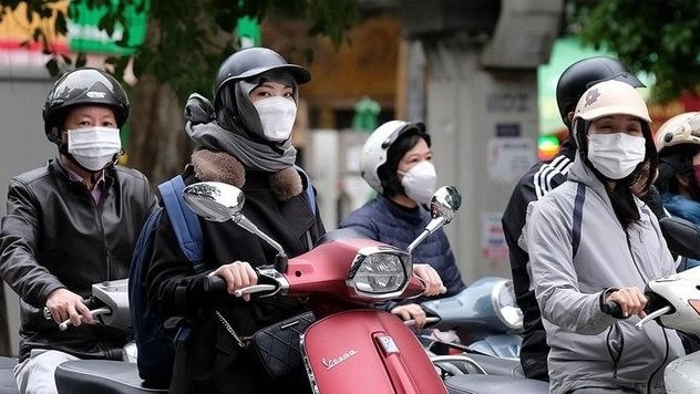
From January 26, this northeast monsoon will cause temperatures to drop sharply in the northern provinces. On January 26-27, the northern region will experience cold weather, accompanied by light rain, with the lowest temperature below 13 degrees Celsius. The average daily temperature will remain below 20 degrees Celsius, with a high possibility of severe cold in many places.
From December 28 to the third day of Tet, cold air continues to cover the North. The weather in the region remains cold, especially in mountainous areas where there is a possibility of severe cold. In the Northeast region, there will be light rain and drizzle, increasing the feeling of coldness and humidity.
Meanwhile, the North Central region is also directly affected by this northeast monsoon with cold weather and light rain in some places. From the Central Central to the South Central region, scattered showers are forecasted in the days before Tet (December 27-29), making the weather in the region cooler.
In the Central Highlands and the South, the Tet weather is generally less rainy, sunny during the day and there are no signs of heat.
However, from the 2nd to the 5th of Tet, the coastal areas of the Southeast region will experience high tides. The peak tide is forecast to reach 4.1 m, causing localized flooding in some coastal areas and river mouths. Residents and tourists should pay attention to the situation to proactively respond.
Weather forecast for 3 regions across the country on the occasion of Lunar New Year 2025:
Northern weather: There are forecasts of severe cold spells, especially in mountainous and midland areas.
• January 25 (December 26): Cold weather, temperature ranges from 10 - 15 degrees Celsius, there may be light rain.
• January 26 (December 27): Continued cold, temperature 9 - 14 degrees Celsius, cloudy sky.
• January 27 (December 28): Cold, temperature 8 - 13 degrees Celsius, drizzle.
• January 28 (December 29): Cold weather, temperature 10 - 15 degrees Celsius, scattered light rain.
• January 29 (1st day of Tet): Cold weather, temperature 12 - 17 degrees Celsius, light sunshine.
• January 30 (2nd day of Tet): Cold weather, temperature 13 - 18 degrees Celsius, clear sky.
• January 31 (3rd day of Tet): Cold weather, temperature 14 - 19 degrees Celsius, light sunshine.
Central weather: Cold air causes temperature to drop, cold weather, light rain, drizzle.
• January 25 (December 26): Cold weather, temperature 15 - 20 degrees, light rain.
• June 2 (December 27): Cold weather, temperature 14 - 19 degrees Celsius, scattered rain.
• January 27 (December 28): Cold weather, temperature 13-18 degrees Celsius, light rain.
• January 28 (December 29): Cold weather, temperature 14 - 19 degrees Celsius, cloudy.
• January 29 (1st day of Tet): Cold weather, temperature 16 - 21 degrees Celsius, light sunshine.
• January 30 (2nd day of Tet): Cold weather, temperature 17 - 22 degrees Celsius, clear sky.
• January 31 (3rd day of Tet): Cold weather, temperature 18 - 23 degrees Celsius, light sunshine.
Southern weather: The weather is warm and sunny, suitable for fun activities and New Year greetings. However, there may be unseasonal rains in the late afternoon.
• January 25 (December 26): Cool weather, temperature 22 - 30 degrees Celsius, sunny.
• January 26 (December 27): Cool weather, temperature 21 - 29 degrees Celsius, light sunshine.
• January 27 (December 28): Cool weather, temperature 20 - 28 degrees Celsius, sunny.
• January 28 (December 29): Cool weather, temperature 21 - 29 degrees Celsius, clear sky.
• January 29 (1st day of Tet): Cool weather, temperature 23-31°C, light sunshine.
• January 30 (2nd day of Tet): Cool weather, temperature 24 - 32 degrees Celsius, clear sky.
• January 31 (3rd day of Tet): Cool weather, temperature 25 - 33 degrees Celsius, light sunshine.
Forecasting the hydrometeorological situation for 2025, according to the representative of the National Center for Hydrometeorological Forecasting, under La Nina conditions, in the Pacific region, the trade winds will be stronger than average. Convective activity will decrease near the central Pacific region and increase in its western part.
This will result in higher than average rainfall in Southeast Asia, especially Indonesia and southern Vietnam, in the first months of 2025. Southern Vietnam may experience localized unseasonal rains during the dry months. The 2025 typhoon season in the East Sea is forecast to be similar to the long-term average, with about 11-13 storms in the East Sea and about 5-6 storms affecting the mainland.
Heat waves are likely to occur at a level similar to the average of many years. During the first half of March, heat waves may occur in the Southern region and the Central Highlands; the Northwest region and the mountainous areas of the Northwest Central region around April; the Northeast region and the coastal areas of the Central region from around May onwards.
The National Center for Hydro-Meteorological Forecasting said that the heat wave in 2025 will likely not be as severe and prolonged as in 2024.
Regarding cold air, there is a warning of the possibility of severe cold during the period from January to March. Widespread heavy rain is likely to start in June in the North, then gradually move south and end around December in the Central provinces.
In the dry season of early 2025, saline intrusion in the Mekong Delta was higher than the average of many years. From February to April 2025, saline intrusion increased, affecting people's lives and agriculture in localities. However, the saline intrusion was not as serious as in the dry seasons of 2015-2016 and 2019-2020.
From March to July, local drought and water shortage outside the water supply areas of irrigation works are likely to occur in the provinces from Phu Yen to Binh Thuan, Kon Tum, Gia Lai, and Dak Lak.
With such developments, the weather and climate in 2025 should be noted that under La Nina conditions, the trade winds in the Pacific region will be stronger than average, convective activity will decrease in the area near the Central Pacific and increase in the western Pacific. This will cause the Southeast Asian region, especially the Indonesian region, including the southern region of Vietnam, to have higher than average rainfall in the first months of 2025 (there is a possibility that the southern region of Vietnam will experience localized unseasonal rain during the dry months).
In Hai Duong:
According to the forecast of the Hydrometeorological Station, from January 22 to 25, the cold air will weaken rapidly and move eastward. The weather in the province will be cloudy, with light fog and light rain in some places at night and in the morning. In the afternoon, the clouds will decrease and the weather will be sunny, with northeast to east winds at level 2, and the weather will be cold. The average daily temperature in the province will gradually increase to 15 - 24 degrees Celsius.
Around January 26-27, cold air is likely to strengthen again, the weather in the province will be cloudy, with scattered rain and light rain, northeast wind level 2-3, cold weather.
On January 28, cold air continued to be added, Hai Duong area was cold, especially at night and in the morning it was very cold with the lowest temperature of 13 degrees Celsius, the highest of 21 degrees Celsius.
Then it continued to get cold.
PV (synthesis)