Heat waves will come earlier, leading to the risk of water shortages in all three regions, saline intrusion in the 2023-2024 dry season at a higher level than the average of many years, storms and tropical depressions forming in the East Sea may be more frequent...

The World Meteorological Organization (WMO) officially confirmed on January 12, 2024 that the average global temperature in 2023 was the hottest year in the past 174 years. Based on the six leading international datasets used to monitor global temperatures, which were consolidated by WMO, the average global temperature in 2023 was about 1.45 degrees Celsius higher than the average temperature in the pre-industrial period (1850-1900).
Mr. Hoang Phuc Lam, Deputy Director of the Center for Hydro-Meteorological Forecasting, said that in the general trend of rising global temperatures, in Vietnam, the average temperature nationwide was also 1.09 degrees Celsius higher than the average of many years and was recorded as the year with the second highest temperature in the observation data series (2019 was the year with the average temperature nationwide being 1.21°C higher than the average of many years). Notably, most months of the year observed the absolute highest daily temperature value exceeding the historical value of the same period, especially the months of May and June 2023.

In 2023, there were 8 tropical cyclones in the East Sea, including 5 storms and 3 tropical depressions (TLDs). The number of storms/tropical depressions active in the East Sea was lower than the average of many years. Notably, in 2023, storms almost did not make direct landfall, so they did not cause strong winds inland. However, other records were set showing that weather abnormalities and climate change are becoming increasingly serious.
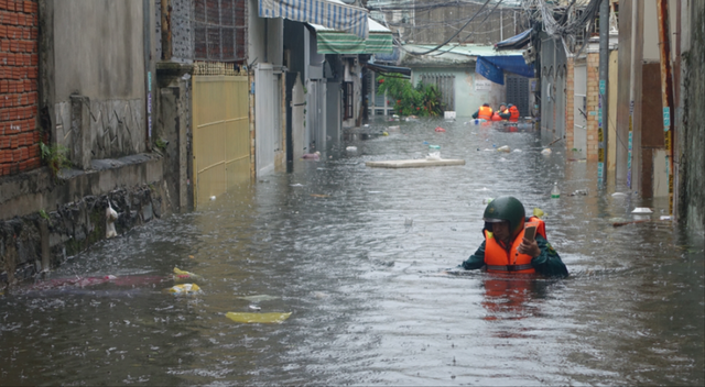
Mr. Hoang Phuc Lam said that in 2023, there were 22 large-scale heavy rains nationwide, mainly concentrated in the Northern and Central regions. Notably, there were many short-term extreme rains with 24-hour rainfall in some places over 800mm in the Central region. Thua Thien Hue was the most severely affected place in this flood. The water level at Kim Long and Phu Oc stations were both above BĐ3 and statistics showed that this was the highest water level in the past 10 years and the 5th highest in the past 30 years.
In 2023, there were 20 heat waves. Since 2017, 2023 has been the year with the most widespread heat waves and 5 more than the average. Notably, in Tuong Duong (Nghe An), the highest temperature was observed at 44.2°C on May 7, 2023, which is the highest daily temperature ever observed in the country (the previous record was 43.4°C in Huong Khe (Ha Tinh) on April 20, 2019).
In 2023, there were 24 cold spells, less than the average of many years (average of many years is about 29-30 spells). In Mau Son (Lang Son) on December 22, 2023, the lowest temperature dropped to -2.5 degrees Celsius, the lowest temperature value in the same period in December according to data recorded in Mau Son from 2012 to present.
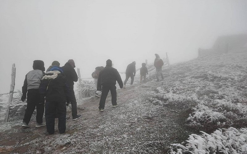
Commenting on the development of natural disasters in 2024, Mr. Hoang Phuc Lam said that from January 20, 2024, the Northern and Central provinces of our country began to be affected by the strongest cold air mass of the 2023-2024 winter season; the Northern and North Central regions have experienced widespread cold spells (average daily temperatures below 13 degrees Celsius), and frost has occurred in many places in the northern mountainous areas (Lang Son, Cao Bang, Quang Ninh). It is forecasted that the current widespread cold spell will likely last until around January 28; during this widespread cold spell, the lowest temperature recorded in the North was in Mau Son: -2.9 degrees Celsius on the night of January 23 and early morning of January 24, 2024.
According to forecasts, the El Nino phenomenon will appear from mid-2023 and will continue until April 2024 with a probability of over 90%. After that, El Nino will weaken and have about a 60% chance of transitioning to a neutral phase in the period from May to July 2024 and about a 50-60% chance of transitioning to La Nina by the end of 2024. If this continues, in 2024, it is necessary to pay attention to storm and tropical depression activities, which will be more concentrated in the second half of the storm season. There may be more storms/tropical depressions forming in the East Sea.
Heat waves in the Southern region, the Northwestern region, the North and the Central region are likely to come earlier and appear more frequently than the average of many years.
After the strong cold spell at the end of January 2024, the cold spell is forecast to be weaker than the average of many years, so the possibility of severe cold in February and March 2024 is lower than the average of many years in the same period. However, it is necessary to be on guard against strong cold spells, especially in February 2024, which can cause severe cold over a large area and the risk of ice and snow in the mountainous areas of the North.
In addition, light rain and drizzle in the Northern region in the Winter-Spring season of 2023-2024 are likely to occur more frequently than the average of many years. Warning of water shortage risk in the first half of the year in the Northern, Central, Central Highlands and Southern regions.
Experts predict that saline intrusion in the dry season of 2023-2024 will be higher than the average of many years, but not as severe as in 2015-2016 and 2019-2020. The highest saline intrusion periods in the Mekong Delta are likely to be concentrated in February-March 2024 (from February 8-13, from February 22-27, from March 18-25); in the Vam Co and Cai Lon rivers in March-April 2024 (from March 8-13, from March 22-27, from April 7-12, from April 21-26).
Faced with complex weather developments, the National Center for Hydro-Meteorological Forecasting and the General Department of Hydro-Meteorology direct relevant units to continuously monitor and fully and promptly transmit all types of automatic measurement data (rain, water level, other hydro-meteorological factors) with satellite data and weather radar; paying special attention to the application of heavy rain estimates from radar, high-resolution satellites, and automatic rain monitoring networks to provide detailed warnings and forecasts of the risks of heavy rain, flash floods, and landslides to small areas, districts, communes, and key areas at high risk.
In addition, this year, online warnings will also be enhanced, digital transformation will be promoted to gradually meet the requirements of natural disaster information to the community, including a landslide risk warning information page that is updated hourly, and warnings of landslide risk points will also be tested through mobile phone applications.
HA (according to Health and Life)