Develop a response scenario suitable for a tropical depression that is about to strengthen into a storm
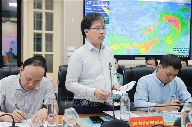
On the afternoon of September 18, the Ministry of Agriculture and Rural Development held a meeting to respond to the tropical depression in the East Sea in person in Hanoi and online with 11 coastal provinces and cities from Ninh Binh to Binh Dinh.

At the meeting, Deputy Minister of Agriculture and Rural Development Nguyen Hoang Hiep said that if it strengthens into storm No. 4, there will be heavy rain in the Central region, and it is necessary to develop a suitable response scenario.
The 2000 Central Vietnam flood scenario may repeat itself
Speaking at the meeting, Deputy Minister of Agriculture and Rural Development Nguyen Hoang Hiep said that according to the forecast of the National Hydrometeorological Agency, in the next 24 hours, the tropical depression is likely to strengthen into a storm. Therefore, localities affected by tropical depression and storms are requested to strictly implement Official Dispatch No. 97/CD-TTg dated September 17 of the Prime Minister and Official Dispatch No. 6851/CD-BNN-DD of the Ministry of Agriculture and Rural Development.
Deputy Minister Nguyen Hoang Hiep requested provinces and cities to resolutely call on and guide ships and vehicles (including tourist ships, transport ships, especially small transport ships) still operating at sea and along the coast to proactively escape from dangerous areas or return to shelters, including grasping detailed information about each ship in the area at risk of being affected by the tropical depression that is likely to strengthen into a storm; organize and arrange ships at anchorages to ensure safety.
"If it strengthens into storm No. 4, it will not be a very big storm but will cause heavy rain in the Central region, focusing on the provinces and cities of Quang Tri, Da Nang, Quang Ngai... and it is very likely that the scenario will repeat itself like the rain in the Central region in 2000. Therefore, localities need to do a good job of reviewing areas at risk of flooding and evacuating people to safe places. In particular, localities need to pay close attention to post-storm circulation, which often causes great damage to people and property; it is necessary to focus on building appropriate response scenarios, not being subjective in responding to tropical depressions and storms," Deputy Minister Nguyen Hoang Hiep emphasized.
Deputy Minister Nguyen Hoang Hiep also requested localities to ensure the safety of key sea dykes and river dykes that are vulnerable or under construction; check and prepare plans to ensure the safety of reservoirs and downstream areas, especially small hydropower reservoirs and vulnerable irrigation reservoirs; and arrange standing forces to be ready to operate, regulate and handle situations.
Ministries, branches and localities, based on their functions and tasks, shall effectively direct the response to storms and tropical depressions. The Department of Dyke Management and Natural Disaster Prevention and Control shall, based on the situation of tropical depressions and storms, report to the leaders of the Ministry of Agriculture and Rural Development and the Prime Minister to establish delegations to localities to inspect and direct the response to tropical depressions and storms.
Heavy rain with risk of flash floods and landslides in Central Vietnam
According to Director of the National Center for Hydro-Meteorological Forecasting Mai Van Khiem, at 1 p.m. on September 18, the tropical depression was in the East of Hoang Sa area, about 530 km east of Da Nang. In the next 6 hours, the tropical depression will move west at a speed of 15 km/h. In the next 24 hours, the tropical depression is likely to strengthen into a storm.
"International forecasting agencies such as Japan, China, and Hong Kong (China) all share the same opinion that the tropical depression will strengthen into a storm," informed Mr. Mai Van Khiem.
Due to the influence of low pressure and storms, from the evening of September 18, the sea area of Quang Tri - Quang Ngai (including Ly Son island district, Cu Lao Cham, Con Co, Hon Ngu) has winds of level 6-7, waves of 2-4m.
On the day and night of September 19, the area from Nghe An to Quang Ngai (including the island districts of Ly Son, Cu Lao Cham, Con Co, Hon Ngu) will have strong winds of level 6-7, waves 2-4m high, the area near the storm center will have strong winds of level 8, gusts of level 10, waves 3-5m high, rough seas.
Warning: The northern and central East Sea areas have waves 3-5m high; offshore the Central region, waves 3-5m high; coastal areas from Nghe An to Quang Ngai have waves 2-4.5m high; areas from Nghe An to Ha Tinh have waves 2-3m high; areas from Quang Binh to Hue have waves 3-4.5m high; areas from Da Nang to Quang Ngai have waves 2-4m high.
In addition, coastal areas from Quang Binh to Quang Ngai (including Ly Son island district, Cu Lao Cham, Con Co) will be affected by a combination of high tides, storm surges and big waves, so there is a risk of flooding in low-lying coastal areas, riverbanks, ship/boat anchorage areas, aquaculture areas and coastal landslides, especially at midnight and noon on September 18-19.
On land, from early morning on September 19, the coastal area from Quang Binh to Quang Nam gradually increased to level 5, with some places reaching level 6, gusting to level 8. From noon to night on September 19, the coastal area from Ha Tinh to Quang Nam had strong winds of 6-7, near the storm's eye level 8, gusting to level 10, and as the storm moved further inland, the winds reached level 6-7.
Along with that, the provinces and cities in the North and Central Central regions have rainfall from 100-300mm, in some places over 500mm; there is a very high risk of flooding, flash floods, and landslides in the above areas.
The area from Quang Tri to Thua Thien - Hue and Da Nang has rain from 200-300mm, some places over 600mm (raining time from early morning of September 18-19). The area of Quang Binh, Ha Tinh has rain from 150-300mm, some places over 500mm. The area of Nghe An, Thanh Hoa, Quang Nam, Quang Ngai has rain from 70-150mm, some places over 200mm.
On rivers from Thanh Hoa to Quang Nam, there is a possibility of floods, with flood amplitudes rising in the upper reaches of rivers from 3-7m. The upper reaches of Ma River, Buoi River (Thanh Hoa), the upper reaches of Ca River (Nghe An) are at alert level 1- alert level 2 and above alert level 2; the flood peak on Ngan Sau River, Ngan Pho River (Ha Tinh) is at alert level 2- alert level 3; the lower reaches of Ma River (Thanh Hoa), La River (Ha Tinh) are at alert level 1; the lower reaches of Ca River (Nghe An) are above alert level 1.
Rivers from Quang Binh to Quang Nam have reached alert level 1 - alert level 2, some rivers are above alert level 2; small rivers in Quang Binh and Quang Tri are likely to reach alert level 3; there is a high risk of flooding in low-lying areas along rivers, urban areas, cities and areas from Nghe An to Quang Nam.
"Starting from the afternoon of September 18, there is a possibility of high waves spreading to the Central coast," Director Mai Van Khiem noted.
Due to the impact of heavy rain, mountainous and midland areas of the provinces of the North Central, Central Central and Central Highlands regions, especially the provinces from Nghe An to Quang Ngai, Kon Tum, Dak Nong and Lam Dong, are at risk of flash floods and landslides.
Proactively respond to tropical depressions/storms

According to Colonel Nguyen Dinh Hung, Head of the Search and Rescue Department, Border Guard Command, the unit has issued two dispatches directing the response to tropical depressions and storms, paying attention to supporting people in securing their houses and anchoring boats in safe places...
As of 11:00 a.m. on September 18, the Border Guard force had counted and instructed 66,960 ships/306,725 people to know the developments and direction of the tropical depression to proactively move to avoid it, of which 75 ships/618 people were operating in the North East Sea and Hoang Sa area; ensuring that no vehicles were in the danger zone; vehicles in the affected area were moving to avoid it.
Colonel Pham Hai Chau, Deputy Director of the Department of Search and Rescue, General Staff of the Vietnam People's Army, said that the military has prepared 268,806 officers with more than 4,000 vehicles to respond to tropical depressions and storms.
Vice Chairman of the People's Committee of Thua Thien - Hue province Hoang Hai Minh affirmed that the province has developed 4 plans to evacuate people when there is heavy rain, especially in key areas such as A Luoi, Nam Dong...
Mr. Tran Chi Cuong, Vice Chairman of the People's Committee of Da Nang City, stated that the city has assigned members of the Standing Committee of the City Party Committee to localities to direct response work; at the same time, on the afternoon of September 18, Da Nang City allowed students to stay home from school...